Smith Rock State Park –great geology at the edge of Oregon’s largest caldera

Smith Rock, the Crooked River, and modern Cascade volcanoes from Misery Ridge.
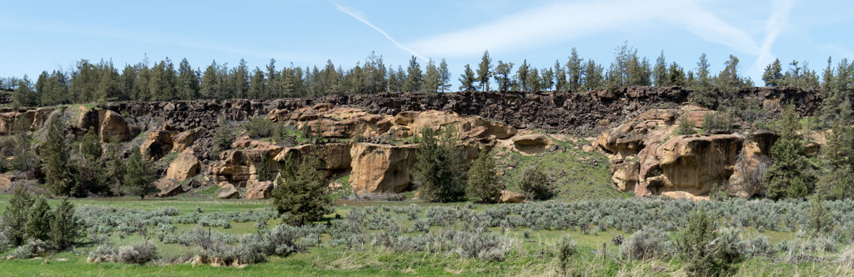
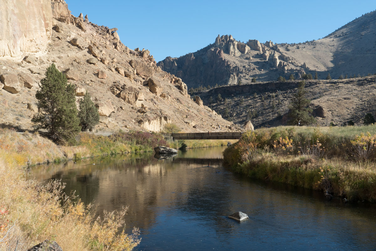
The view from outside the small visitor center at Smith Rock State Park offers a landscape of contrasts. The parking lot, and nearby camping and picnic areas, are flat, underlain by the edge of a basaltic lava flow that drops off in a series of steps to a narrow canyon, some 120 feet (37 m) below. The Crooked River, which rises about 100 miles (162 km) away in the High Lava Plains, fills much of the canyon bottom. Across the canyon, tan cliffs and spires of tuff, another volcanic rock, soar overhead. Smith Rock itself forms a peninsula of this rock, enclosed by a hairpin bend of the Crooked River. The tuff erupted 29.5 million years ago in the largest volcanic eruption to occur entirely within Oregon.
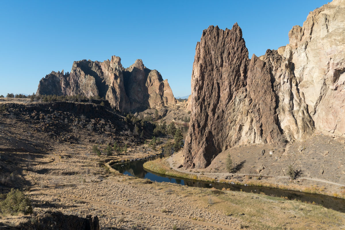
View down the Crooked River from near the parking lot. On the left is the Newberry basalt flow; the reddish tower just right of the river is the rhyolite dike intruding the Smith Rock Tuff.
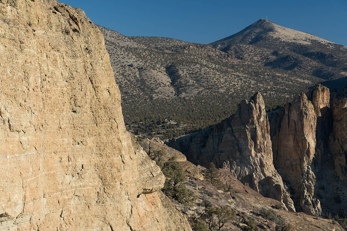
The eruption created the gigantic Crooked River Caldera, which stretches like an ellipse southeastward from Smith Rock more than 20 miles (32 km) and traversed along its length by the Crooked River. Around its perimeter are rhyolite bodies that intruded after the eruption along ring fractures surrounding the caldera. These rhyolites include Gray Butte, just north of the park, Grizzly Mountain, to the northeast, and Powell Buttes, some 15 miles (24 km) to the southeast. The imposing red-colored tower, just downstream from the hikers’ bridge in the state park, is a rhyolite dike that also intruded after caldera collapse.

Geologic maps: of Smith Rock State Park (left) and the Crooked River Caldera (right). Compiled from McClaughry et al. (2009A), Robinson and Stensland (1979), Walker and MacLeod (1991), and the State Park trail map.
Some of the finer-grained, airborne material likely accumulated 75 miles to the east to form much of the green-colored Turtle Cove Member of the John Day Formation, which has the same age. All told, the eruption produced more than 140 cubic miles (580 km3) of material. The eruption size as well as its caldera, however, eluded detection until about 2006 when Jason McClaughry and Mark Ferns of DOGAMI completed detailed mapping of the region. Now, some researchers even consider the eruption to be an early phase of the Yellowstone hot spot!
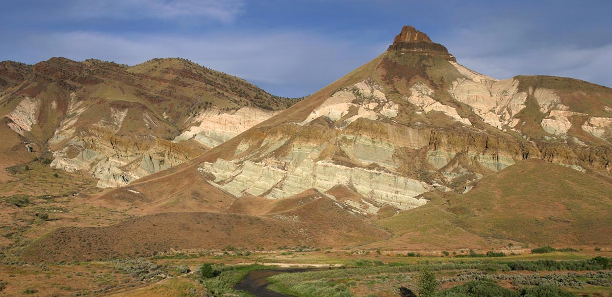
Much of the green Turtle Cove Member of the John Day Formation, so well exposed at John Day Fossil Beds National Monument, was probably derived from alteration of ash derived from eruption of the Crooked River Caldera, 29.5 million years ago.
Hiking any of the state park’s numerous trails gives you plenty of chances to see the rock close-up. It’s pretty much all tuff, the volcanic rock made mostly of consolidated ash and pumice. Many tuffs become welded into hard rocks because of the high temperatures as they compact, but most of these tuffs are not welded and so relatively soft. Some exceptions include the red-colored welded tuffs at the crest of the Misery Ridge trail.
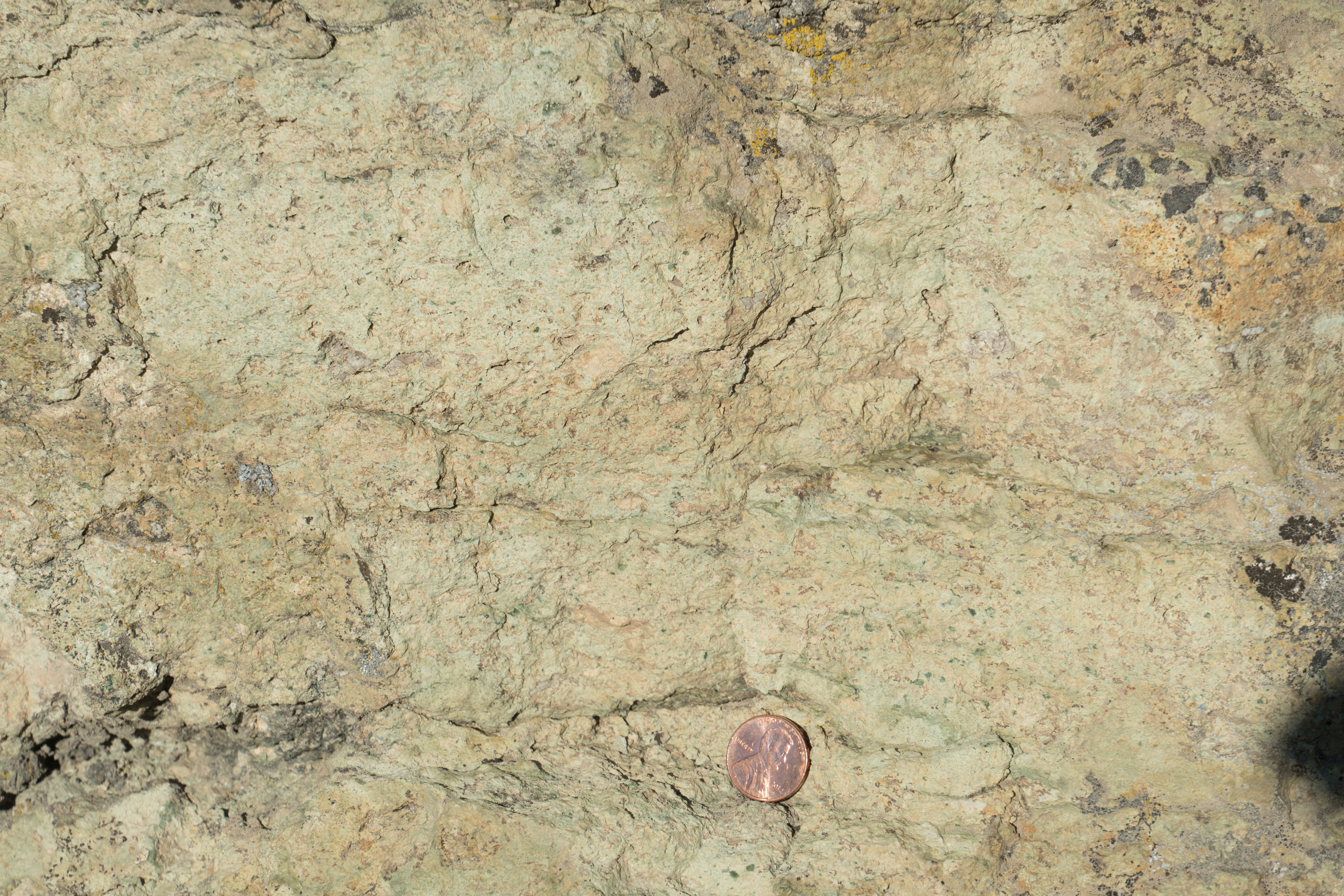
Close-up view of the Smith Rock Tuff. The faint green layers contain a higher proportion of fine ash, whereas the intervening areas typically contain coarser ash and more pumice. The greenish color consists of the alteration mineral celadonite.
You might also notice that parts of the cliffs display layering inclined roughly southward. Up-close, you can see that some layering is defined by subtle changes in the proportions of fine to coarse ash to suggest variations in the ferocity of the eruption. Many layers contain small rock fragments, the rocks being older material incorporated into the eruption. Most of these rocks are volcanic, derived from the underlying Clarno Formation. A tiny fraction, however, are pieces of Permian-age limestone. These limestones are significant as they came from the basement rock, accreted to North America during the later Jurassic or early Cretaceous periods.
Fine-scale layering in the Smith Rock Tuff
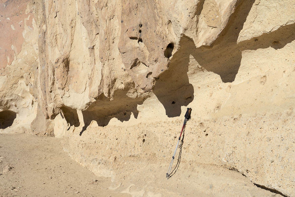
Numerous pocket-like holes dot many of the cliff faces. The outer edges of these features typically consist of more durable rock whereas the insides typically consist of softer, more easily erodible material. The durable crusts form because minerals in the tuff dissolve in pore water and re-precipitate on the surface as the pore water evaporates. At Smith Rock, the responsible minerals are mostly zeolites, a group of minerals with wide-ranging compositions but containing silica, aluminum, and water. Along with the enhanced weathering and erosion along fractures, this case-hardening results in an endless variety interesting shapes and pinnacles.
The case hardening also creates outstanding surfaces for climbing, so on sunny weekends, the state park draws hundreds of rock climbers of all abilities. Considered one of Oregon’s top climbing areas, Smith Rock offers more than 1500 routes. Moreover, the cliffs are recognized as the birthplace of American sport climbing, which unlike traditional climbing, benefits from anchors placed permanently in the rock

Rock climber reveling in a crack on the pillar called “Monkey Face”. Note the reddish upper part of the rock –it’s welded tuff above the non-welded tuff. Note also the layering in the tuff.
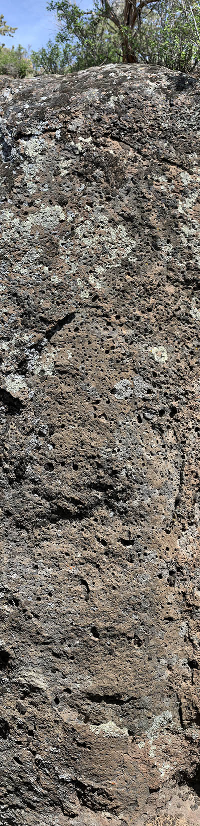 The basaltic lava flows at the state park have their own story, as they originated from vents on the north side of Newberry Volcano some 400 thousand years ago. If you look closely at the basalt, you’ll see that it’s uniformly very finely crystalline, but in some places full of air bubbles called vesicles. Because gases tend to rise through lava flows, the vesicles tend to become larger and more abundant towards the top of individual flows–as shown in the photo on the left –although you really need to click on it to see the larger version. The photo is 4 feet high from bottom to top.
For the most part, the lavas covered the older Smith Rock Tuff. They blanket the southwestern part of the caldera and sit on top the tuff in many places within the canyon. However, the cliffs of Smith Rock soar far above, so the lavas had to flow around them on their way to the Deschutes Canyon, some ten miles to the northwest. The interface between the high-standing tuff and the basaltic lava must have been highly irregular to make it ripe for erosion by the Crooked River, which now meanders through a lovely gorge.
And this post! It’s a draft of an entry I’m planning for my upcoming book, “Oregon Rocks!” –to be published by Mountain Press, probably sometime in 2021. I’m only allowed a few photos per entry, so here are a few more! You can click on each to see them at a larger size.
Newberry Basalt overlying Smith Rock Tuff on the west side of the Crooked River, just downstream from its hairpin bend. Note the channeled base of the basalt.
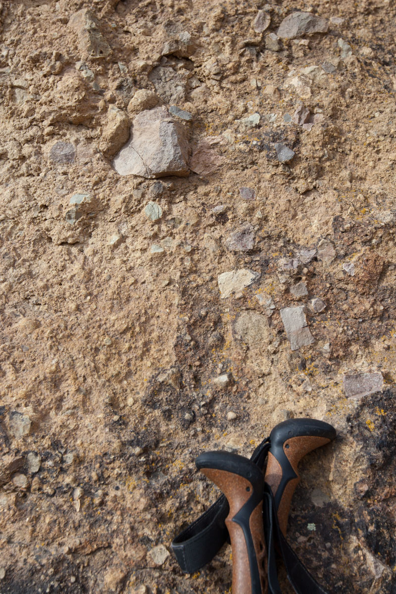
Lithic (rock) fragments in the tuff

View northward from the west side of Misery Ridge, showing the red-colored welded part of the tuff overlying the less welded part.
Contact of ash-and pumice-rich tuff overlying lithic-rich tuff near the bottom of the Misery Ridge Trail.
View upstream: tuff on the left and in the background; basalt in the right middleground.

Some useful references:
Bishop, E.M., 2003, In search of ancient Oregon: Timber Press, Portland, 288p.
McClaughry, J.D., Ferns, M.J., Gordon, C.L., and Patridge, K.A., 2009A, Field trip guide to the Oligocene Crooked River caldera: Central Oregon’s Supervolcano, Crook, Deschutes, and Jefferson Counties, Oregon, Oregon Geology, v. 69, p. 25-44.
McClaughry, J.D., Ferns, M.L., Streck, M.J., Patridge, K.A., and Gordon, C.L., 2009B, Paleogene calderas of central and eastern Oregon: Eruptive sources of widespread tuffs in the John Day and Clarno Formations, in O’Connor, J.E., Dorsey, R.J., and Madin, I.P., eds., Volcanoes to Vineyards: Geologic Field Trips through the dynamic landscape of the Pacific Northwest: Geological Society of America Field Guide 15, p. 407-434.
Miller, M.B., 2014, Roadside Geology of Oregon: Mountain Press, Missoula, 386p.
Robinson, P.T., and Stensland, D.H., 1979, Geologic Map of the Smith Rock Area, Jefferson, Deschutes, and Crook Counties, Oregon. US Geological Survey Miscellaneous Investigations Map I-1142. 1:48,000.
Walker, G.W., and MacLeod, 1991, Geologic Map of Oregon. US Geological Survey. 1:500,000.
And some links:
Smith Rock State Park: https://oregonstateparks.org/index.cfm?do=parkPage.dsp_parkPage&parkId=36
Climbing article: https://www.climbing.com/places/thanks-volcanoes-climbing-in-oregon/

Marli,
That you still write, & I can still read your work, provides immeasurably positive moments of hope & perspective — thank you!
Trippett
LikeLike
Thank you Larry! Your comment means a lot to me.
LikeLike
Great stuff.
Steve M. Carlson scarlson@pdx.edu
>
LikeLike
Thank you!
LikeLike
Been doing some “Looking” in the Mutton Mountains at that caldera. You know much about it? I’m taking a Discovery Center group through it next month. Want to tag along? We will be leaving the Dalles, through Tygh ridge, up out of Tygh Valley to Wamic and then through White River Canyon, (Where the Caldera is most evident.) then across to Warm Springs, through the Simtustus FM, to Cove, Back to Smith Rocks, and then home. Ought to be interesting. The hillside out of Tygh Valley is not mentioned many places but its a great example of the NW/SE faulting in the Pliocene materials. Field guides talk about the Western Cascades glacial outwash but the Deschutes formation is quite evident and seriously faulted. Down 197 we will stop at the pillow lavas that evidently bulldozed lake sediments and opalized them. Steve M. Carlson scarlson@pdx.edu
>
LikeLike
Hi Steve, Thanks for the invite! It sounds like a great trip –although I’m a little confused, as the northern margin of the Crooked River caldera as defined by McClaughry and Ferns lies well to the south of where you’re describing? I’m sorry that my June schedule won’t allow me to tag along -those are great rocks!
LikeLike
Looking very much forward to your book!! The pacific northwest is endlessly fascinating geologically speaking.
Will your book be part of the … rocks! series?
LikeLike
Yes it will! And thanks for the nice comment. I’m hoping to have the manuscript off to the publisher later this fall.
LikeLike
After 60 years scrambling over the rocks from Warm Springs River to that Caldera
and scouting for Gary Smith and Mel Ashwill, studying the works of Obermiller thru Mc Claughry, and after helping get the ages right for all, I have just one comment:
“It just keeps getting better and better – thanks to you, Mari Miller” !!
LikeLike
Thanks for the nice words Gary!
LikeLike
Thanks for the information..I hope your book does well!
LikeLike