Touring the geologic map of the United States
Published in 1974 by the US Geological Survey, the geologic map of the United States beautifully lays out our country’s geology. If you’re stuck at home these days –as most of us are—you can gaze at this masterpiece and go anywhere! 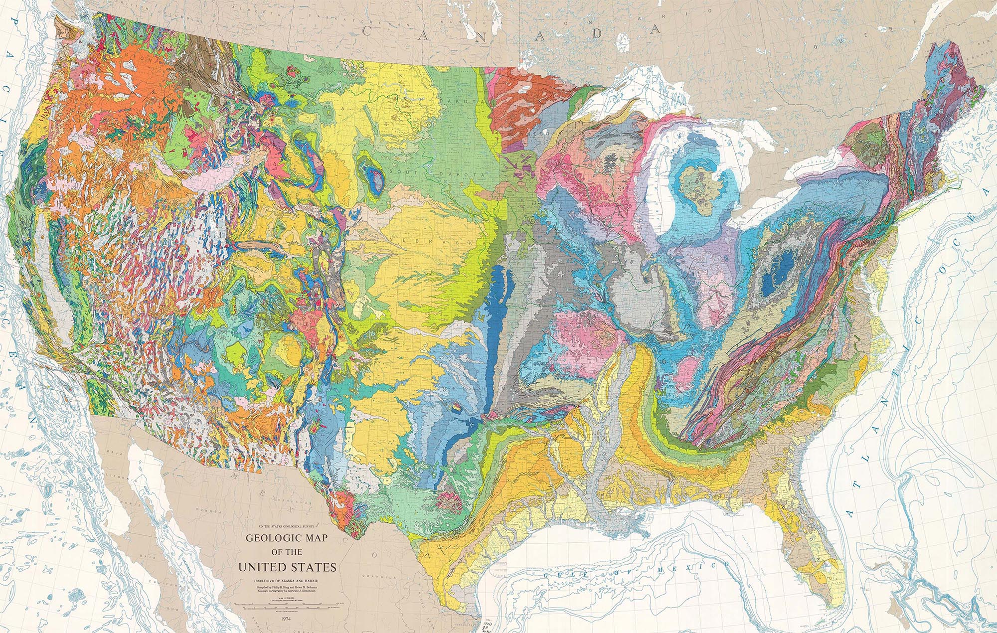
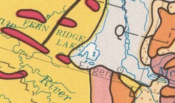
Southern Willamette Valley. Eugene’s in the center of the map
At their simplest, geologic maps read like road maps: they tell you what rock unit or recent deposit forms the ground at a given place. So right here where I am in Eugene, Oregon, I can see that I live on “Q” –which stretches north up the Willamette Valley. “Q” stands for Quaternary-age material (2.5 million years to present), which is typically alluvial material –or sediment deposited by rivers and streams. Just to the south of me lie a variety of older volcanic and sedimentary rocks. You can look them up in the map’s legend using their symbols. Here’s Rule #0: white areas, being mostly alluvium, mark low areas; colorful areas indicate bedrock, so are typically higher in elevation.
The beauty of this map is that you can see the whole country at once, and using just a few rules, can immediately glean the underlying structure of a region.For any of the maps, photos, and diagrams here, you can see a larger size if you click on the image.

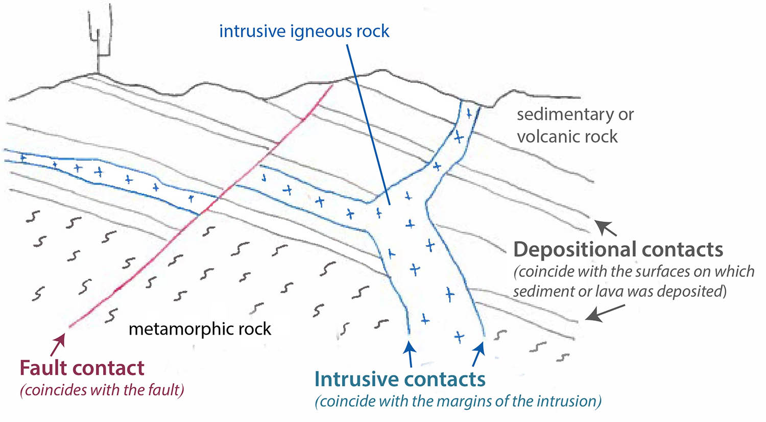
Rule 1: Rock bodies without internal contacts appear as color swatches (or “blobs”) as seen on the block diagram below. These rocks include intrusive igneous, undifferentiated metamorphic, and flat-lying sedimentary rock. (If you’re not sure what geologic contacts are, please see my recent post on the nature of geologic contacts.) Read more…