Washington’s waterfalls–behind each one is a rock!
Of all the many reasons why waterfalls are great, here’s another: they expose bedrock! And that bedrock tells a story extending back in time long long before the waterfall. This posting describes 9 waterfalls that together paint a partial picture of Washington’s geologic history. The photos and diagrams will all appear in my forthcoming book Roadside Geology of Washington (Mountain Press) that I wrote with Darrel Cowan of the University of Washington.
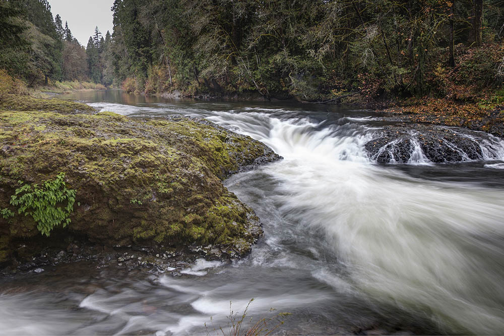
Rainbow falls along WA 6 in the Coast Range
And waterfalls in heavily forested areas are especially great because they may give the only view of bedrock for miles around! Take Rainbow Falls, for example–the small waterfall on the left. It’s in Washington’s Coast Range along State Highway 6–a place where a roadside geologist could otherwise fall into total despair for lack of good rock exposure. But this beautiful waterfall exposes a lava flow of the Grande Ronde Basalt, which belongs to the Columbia River Basalt Group. Significant? Yes!
This lava erupted in southeastern Washington and northeastern Oregon between about 16 and 15.6 million years ago and completely flooded the landscape of northern Oregon and southern Washington. We know how extensive these flows are because we can see them–and they cover the whole region. The photo below shows them at Palouse Falls in the eastern part of Washington. Take a look at my earlier blog post about the Columbia River Basalt Group? (includes 15 photos and a map).
