Hug Point State Park, Oregon, USA –sea cliffs expose a Miocene delta invaded by lava flows
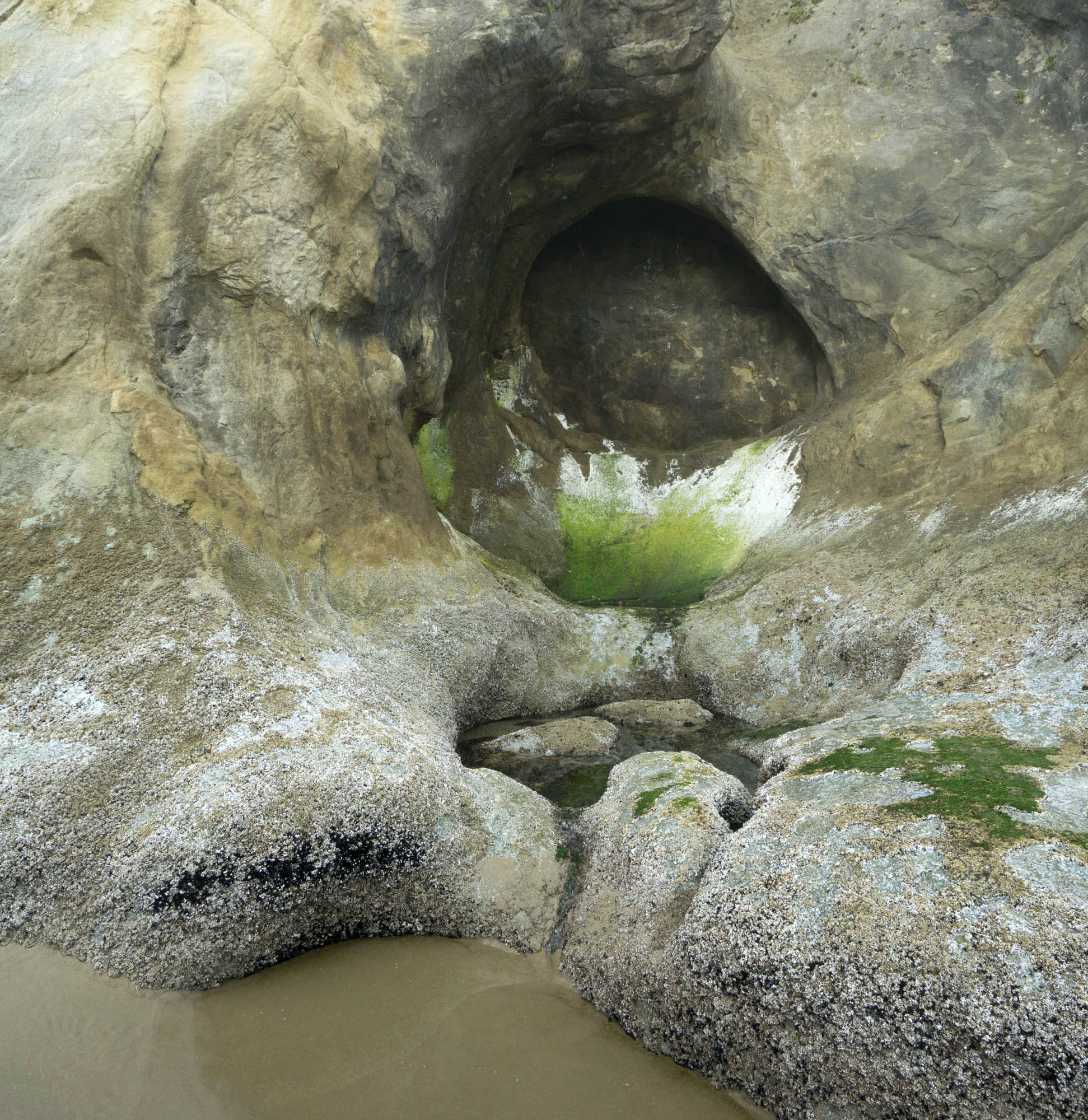
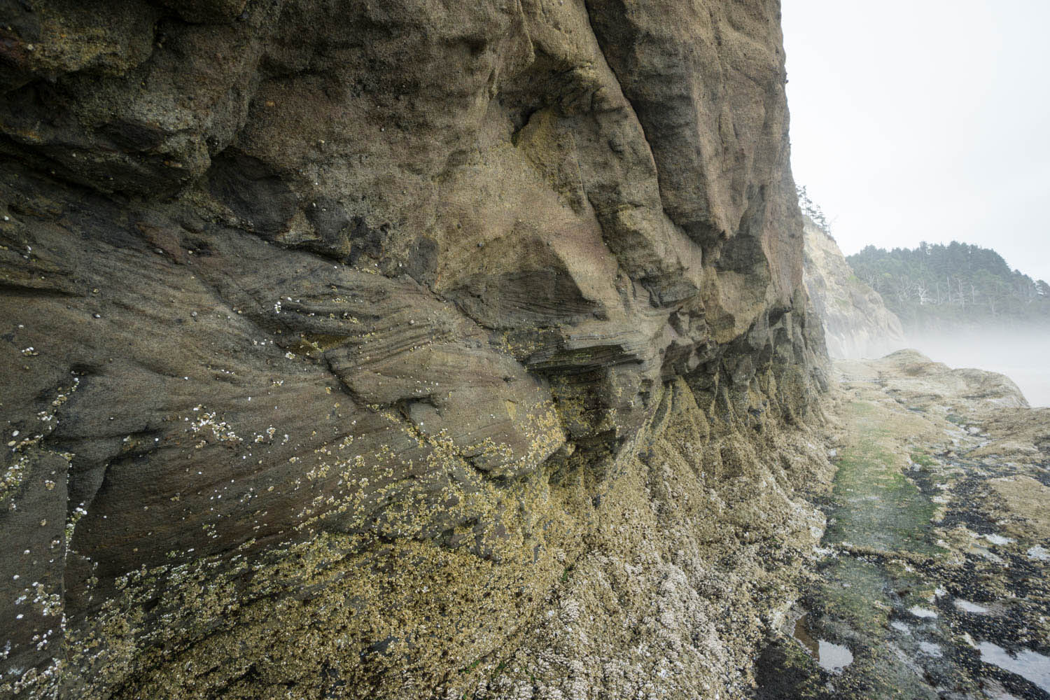
Alcove and tidepool at Hug Point
Imagine, some 15 million years ago, basaltic lava flows pouring down a river valley to the coast –and then somehow invading downwards into the sandy sediments of its delta. Today, you can see evidence for these events in the sea cliffs near Hug Point in Oregon. There, numerous basalt dikes and sills invade awesome sandstone exposures of the Astoria Formation, some of which exhibit highly contorted bedding, likely caused by the invading lava. It’s also really beautiful, with numerous alcoves and small sea caves to explore. And at low to medium-low tides, you can walk miles along the sandy beach!
(Click on any of the images to see them at a larger size)
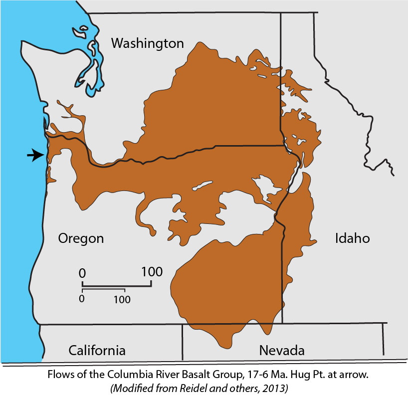 You can read more about the Columbia River Basalt Group on an earlier post, but basically, it mostly erupted from fissures in northeastern Oregon and southeastern Washington between 17-6 million years ago (although most activity ended by 14 Ma). They’re called “flood basalts” because they completely flooded the landscape. Many of the flows made it all the way to the Pacific Ocean. They followed the ancient Columbia River and also probably one farther south across today’s Coast Range.
Most researchers now agree that on reaching the coastline, some of these flows somehow invaded the existing sediments, now mostly the Astoria Formation, to form dikes and sills in the rock. In places, they also inflated weak zones to form shallow magma chambers. Some of these magma chambers are preserved as thick sills along the northern coast, such as at Neahkahnie Mountain, while some actually fed undersea volcanoes, such as Haystack Rock at Cannon Beach.
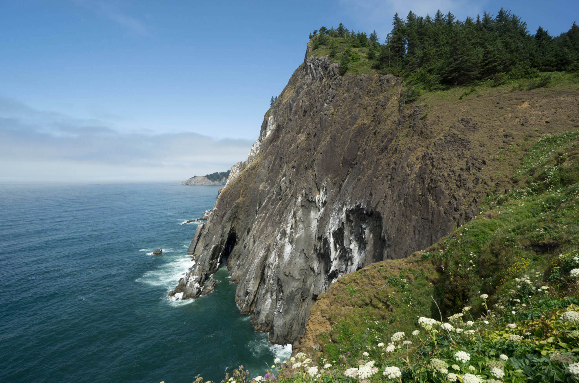
Basalt sea cliffs at Neahkahnie Mountain
Probably the most accessible exposures of the basalt are in the small headlands immediately north and south of the parking lot. If you go south, look for a pair of dikes as well as a sill of the basalt. Just north of the parking lot, you can’t miss the narrow sill that extends diagonally up from a wave-eroded alcove. Walk around the point to see a much larger intrusion that appears to connect with the sill. One of its sides is faulted and has eroded into a small sea cave.
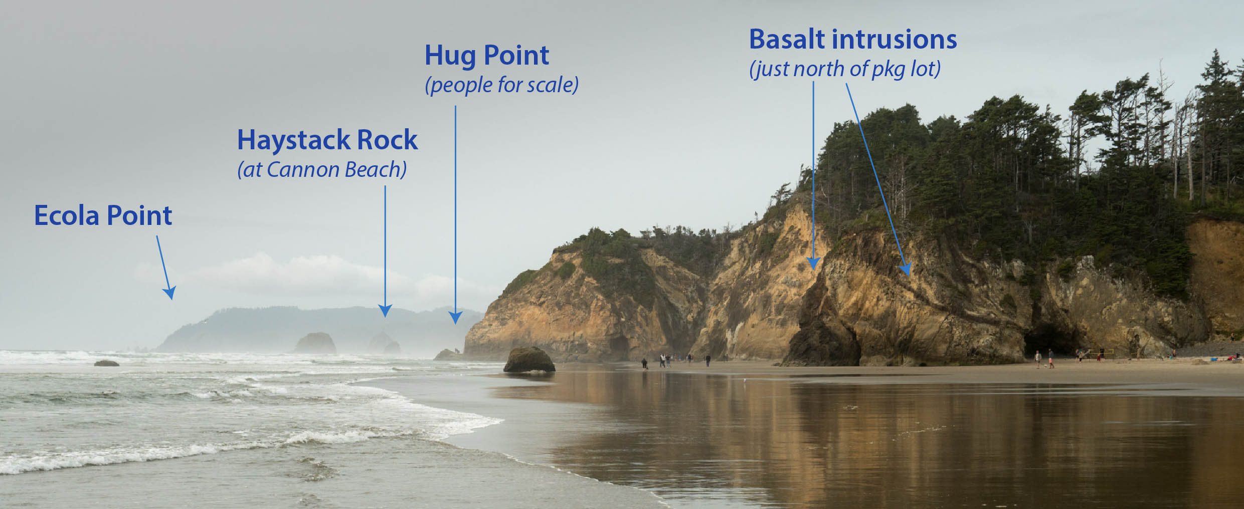
Overview of Hug Point area, looking north past Cannon Beach to Ecola Point, Oregon. If you click on this image, you can see it in another window at a much larger size.
Hug Point itself forms the second headland north of the parking area, and it protrudes far enough into the surf that you practically need to “hug” the rocks to get around, hence its name. In the late 1800’s travelers carved a road along the cliff base, which makes passage relatively easy when the tide isn’t too high. Sandstone of the Astoria Formation along this stretch is coarse grained, with mostly quartz and feldspar grains. You can also see abundant cross-bedding from deposition by currents, as well as rip-up clasts, where storms eroded the underlying bed and included parts of it within the newly deposited sand.
Cross-bedding in Miocene Astoria Formation and road along base of Hug Point. Note the rip-up clasts at the base of the light-colored bed. Also note the barnacles –no passage here at high tide!
This coarse part of the Astoria Formation is called the Angora Peak Member, and was deposited on a delta that was continually affected by waves and storms of the Miocene ocean. The rocks dip gently to the northeast, to indicate younger rocks in that direction.
A cliff of highly contorted sandstone lies Immediately north of Hug Point. The irregular nature of the folding suggests that deformation took place while the Astoria Formation was still soft, hence the term “soft-sediment deformation”. Given the abundance of the basaltic intrusions here, geologists interpret the cause of this folding as related to the intrusions. More effects of the intrusions are the breccias you can see another quarter mile to the north. There, highly fragmented sandstone and basalt are mixed together, a likely product of the explosions that resulted when the lava encountered the water-rich sediment.
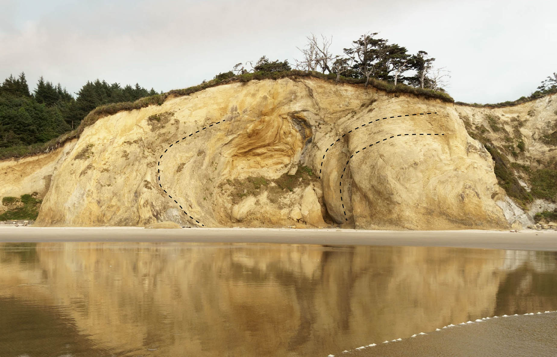
Contorted Astoria Formation in sea cliff.
In another mile, you reach Lion Rock and Humbug Point, where the Astoria Formation shows more interaction with the basalt –and another half mile beyond that, Silver Point. There, a cliff exposes shale of the Astoria Formation’s Silver Point member, deposited in a deeper part of the delta complex. As these rocks sit on top the coarser Angora Peak member, they suggest that the delta was subsiding through time. And if you want to keep walking? Cannon Beach’s Haystack Rock is just another two miles away!
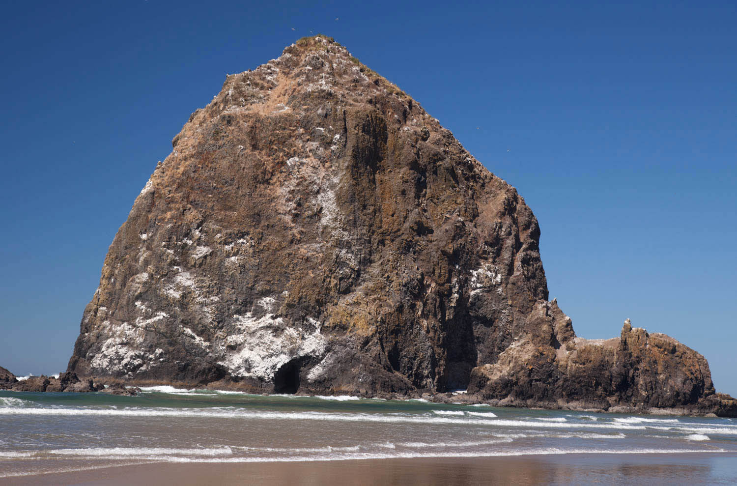
Haystack Rock at Cannon Beach. The vent area of an undersea volcano fed by lavas of the Columbia River Basalt Group!
For more photos of Hug Point, including a closer view of those weird folds, please visit my website, geologypics.com –and type “hug” into the keyword search. All the images there are freely downloadable for noncommercial, personal or instructional uses.
Here’s the reference for the map of the CRBG: Reidel, S.P., Camp, V.E., Tolan, T.L., Martin, B.S. 2013. The Columbia River flood basalt province: stratigraphy, areal extent, volume, and physical volcanology. In The Columbia River Basalt Province, Geological Society of America Special Paper 497, eds. S.P. Reidel, V.E. Camp, M.E. Ross, J.A. Wolff, B.S. Martin, T.L. Tolan, and R.E. Wells, p. 1-44.
And another really good reference for the invasive basalts: Wells, R.E., Niem, A.R., Evarts, R.C., and Hagstrum, J.T. 2009. The Columbia River Basalt Group—From the gorge to the sea. In Volcanoes to Vineyards: Geologic Field Trips through the Dynamic Landscape of the Pacific Northwest, Geological Society of America Field Guide 15, eds. J.E. O’Connor, R.J. Dorsey, and I.P. Madin, p. 737-774.
–This vignette is a draft version of an entry for my latest book project: Oregon Rocks! A guide to the geology of the Beaver State. To be published (probably not until 2021) by Mountain Press in Missoula.

After nearly 30 years in Oregon I only visited Hug Point for the first time last year, even though I’ve stayed in Cannon Beach dozens of times. In terms of geology, I was like a kid in a candy store. There is so much ancient geological activity exposed at Hug Point … wonderful! (And can’t wait for your book in 2021!)
LikeLike
Thanks Wes! (and thanks for the shout-out on FB!). It IS a pretty amazing place, isn’t it? And such a great beach!
LikeLike
As always, Marli, delightful and informative. “Soft sediment deformation”, a useful addition to my vocabulary. Am I right in thinking that lithified sandstone faults under pressure, rather than buckling, or does that depend on the setting?
LikeLike
Thanks Paul! Lithified sandstone can fold or fault–even under pretty significant pressures (super high pressures would tend to inhibit breakage/faulting). Unlithified, “soft” sediment would more likely fold.
LikeLiked by 1 person