Iceland –where you can walk a mid-Atlantic rift –and some other geology photos
While Iceland hosts an amazing variety of awesome landscapes, what stands out to me most are its incredible exposures of the Mid-Atlantic ridge. To the north and south, the ridge lies beneath some 2500m of water, forming a rift that separates the North American plate from the Eurasian plate. The rift spreads apart at a rate of some 2.5 cm/year, forming new oceanic lithosphere in the process. But in Iceland, you can actually walk around in it!
Please click on any of the images below to see them enlarged.

Geologic map of Iceland as compiled from references listed below.
If you look at the geologic map above, you can see two rift zones near Iceland’s mid-section, and that the rocks become older in either direction away from those zones –just what you’d expect. New material erupts in the rift zones as they pull apart, separating the two major tectonic plates. In Iceland there’s a third microplate between the two rifts. The process continues through time, creating volcanic activity with ages somewhat symmetrical about each of the rifts. From the map, you can also see that most of Iceland’s big thermal areas lie within the rift zones.

Geothermal power plant in the Western Rift Zone, just east of Reykjavik
It’s more complicated though. A hot spot beneath Iceland causes increased volcanic activity, which through time, thickened the Icelandic crust to greater than 40 km in places. By comparison, most of the oceanic crust beneath the North Atlantic ranges from 4-7 km thick. Icelandic magma, rising from its source in the underlying mantle, must therefore pass through a lot more rock, which gives it plenty of time and opportunity to evolve into more silicic varieties. If you look at the geologic map’s legend, you can see that besides basalt (which is the rock of the ocean floor), you also see a lot of andesite and even some rhyolite. In fact, Iceland contains numerous stratovolcanoes, several of which have erupted silicic ash and pumice in the last couple thousand years, including Hekla and Snaeffelsjökull, shown on the map.
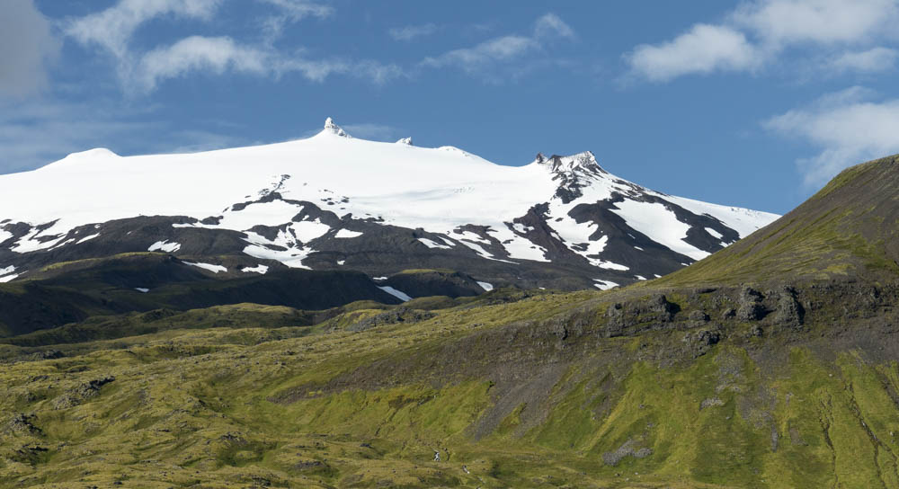
Snæfellsjökull volcano and glacier. There’s a moss-covered basalt flow in the lower part of the photo; the upper reaches of the volcano are more silicic.
What I found so instructive was the physical layout of the rift zones. There’s not a single, discrete crack that marks where all the lava comes up. Each zone is at least several km in width –and marked by numerous discontinuous fissure zones, active at different times than each other. Near Reykjavik, these features are beautifully expressed—and accessible—at Thingvellir National Park as well as along the south coast of the Reykjanes Peninsula.
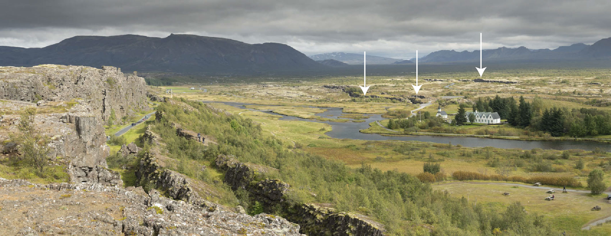
Western Rift Zone at Thingvellir, view northward. Besides the prominent fissures on the left (west), numerous other ones cut the interior of the rift, 3 of which are marked by arrows. The rift continues up the valley behind the arrows.
And the lava flows –they too erupt at different times and different places –and not always from an existing fissure. Sinton and others (2005), for example, map more than 30 different post-glacial flows at various places within the western rift zone. Most of the recent activity, however, lies within the eastern rift zone. Since the year 2000, some six separate eruptions occurred within or at the margins of the eastern rift zone. These eruptions include the 2010 eruption of Eyjafjallajökull, which took place beneath a glacier. The water-magma reactions created a gigantic ash cloud that disrupted European air traffic for nearly a week –my oldest daughter got stranded in Ireland!

Eyjafjallajokull Volcano as seen from island of Heimaey

Through time, the Mid-Atlantic ridge has split N and S America from Europe and Africa (USGS)
These observations are important because we tend to present rifting and its accompanying volcanism as a steady, continuous process. We ask students to imagine opposing conveyor belts moving outwards from a central area to help visualize the process. But more accurately, the conveyor belts are partially broken and rusty and so move in only fits and starts –and mostly, the conveyor belts seem stuck. If you walked through the rift zone on any typical day, you might perceive that the whole process had simply stopped. And that’s the point. At human time scales, this rifting process is inexorably slow, almost imperceptible. But through geologic time it creates the enormous changes we can see.
To make Iceland even more complex –and interesting—the Snaeffelsnes Peninsula, north of Reykjavik, marks an earlier position of the rift. The rift migrated some 6-7 million years ago to today’s western rift zone. The peninsula’s main volcano, the ice-capped Snaeffelsjökull stratovolcano is still potentially active, having last erupted sometime around 200 AD.
Holocene lava flow near Snæfellsjökull
So here’s a bit of a photo dump. I visited the SW third of Iceland during early September, 2018 with my friends Christine and Charlotte and shot nearly a zillion photos. What a landscape! While these are some of my favorite photos, I posted more than 100 others on my geology photo website and they’re all freely available to download. Just type “Iceland” into the search!
click on any photo (including the ones above) to see it larger and in a separate window

Christine and Charlotte one evening
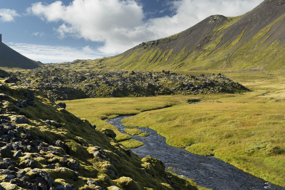
One of my favorites, a gravel bar near the south coast
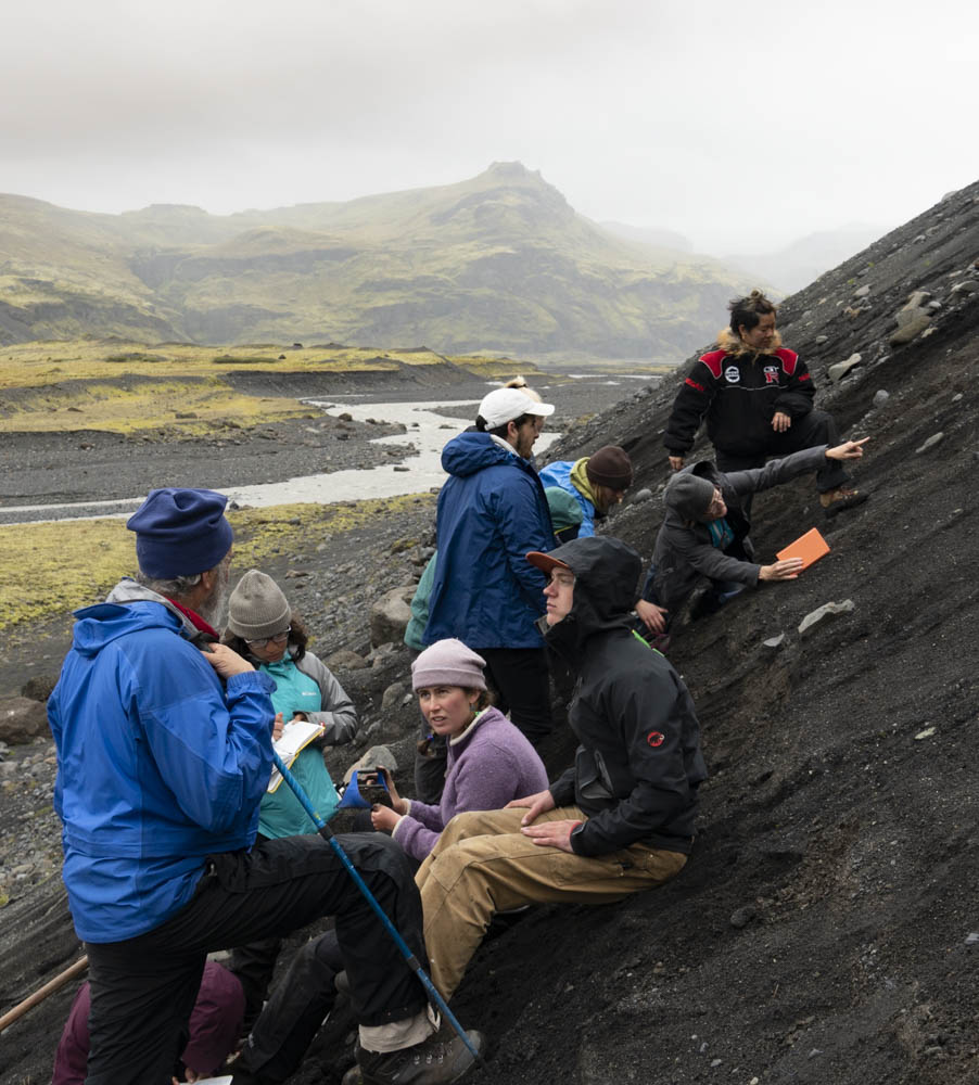
We met up with a Geo group from Colorado College (where Christine teaches) -these are glacial deposits.
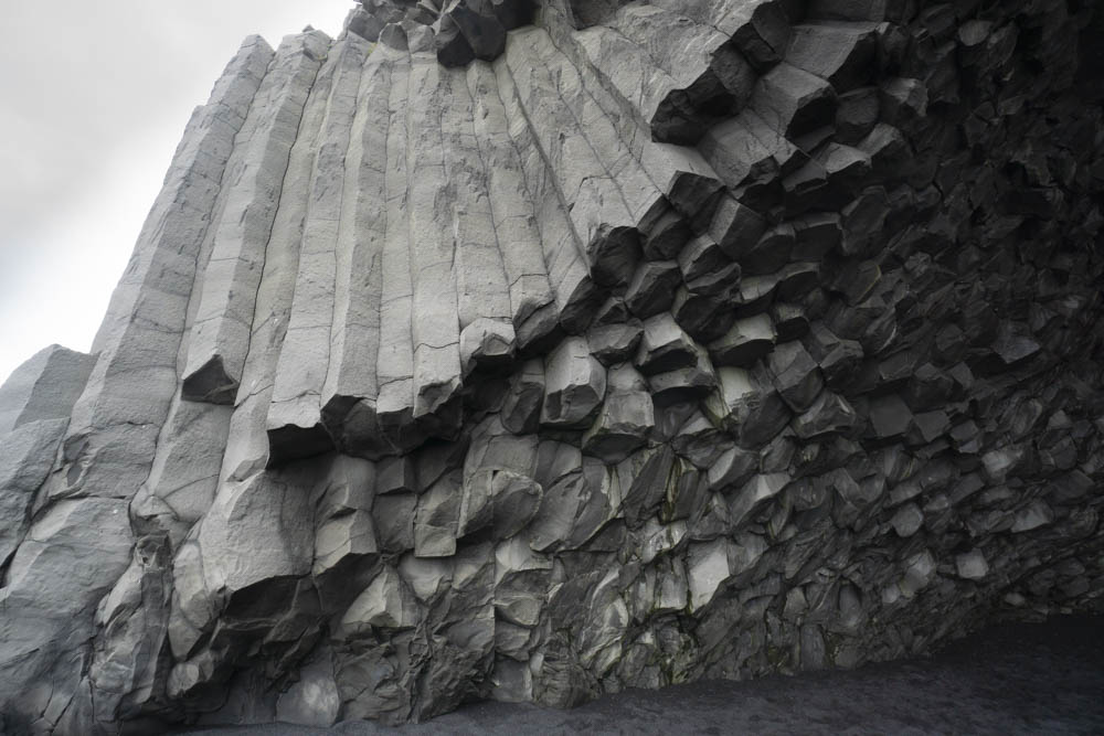
The CC group took us to these basalt columns near Vik –columns in 3D!

Eldfell cinder cone and town on Heimaey. In 1973, the cinder cone erupted, destroying parts of the town and nearly blocking the harbor. Icelanders stopped the lava using seawater!
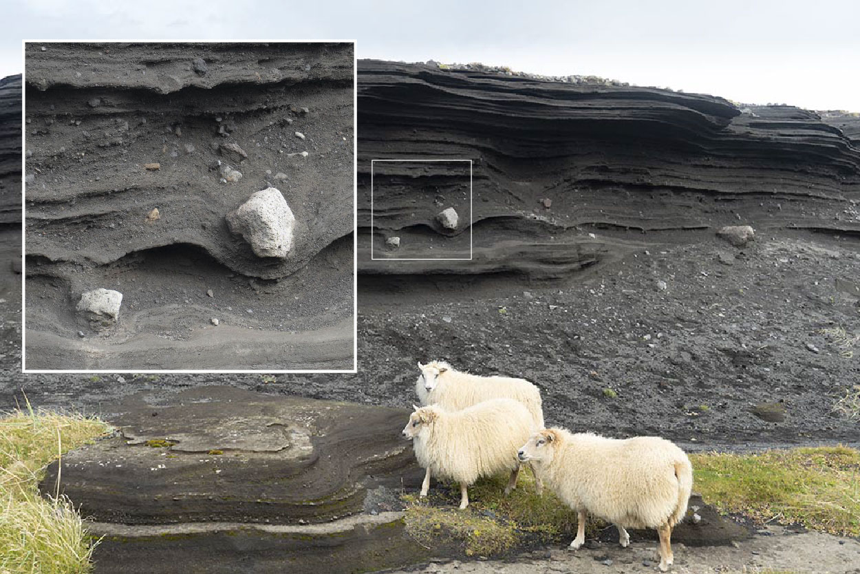
Airfall deposits from earlier eruptions on Heimaey –with projectiles!

One of the fissures in the W Rift Zone of Thingvellir NP.

Christine and a feeder dike
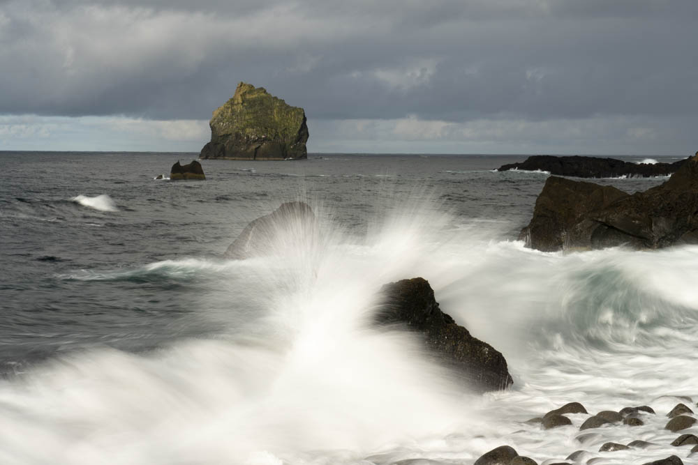
Breaking wave on the S Coast

and moss…
For more geology-related photos of Iceland, please have a look at my site geologypics.com and type “Iceland” into the search function (the red button below the lead photo).
Some References:
Sinton, J., Gronvold, K., and Saemundsson, K., 2005, Postglacial eruptive history of the western Volcanic Zone, Iceland: Geochemistry, Geophysics, Geosystems, v. 6, no. 12.
https://agupubs.onlinelibrary.wiley.com/doi/abs/10.1029/2005GC001021
Great general reference (thanks Tom!) Gudmundsson, A.T., 2007, Living Earth, Outline of the Geology of Iceland, Mál og menning, Reykjavik, 408p.
References used for map:
Jóhannesson, H., 2014, Geological map of Iceland. Bedrock Geology, 1:600,000. Icelandi Institute of Natural History. http://en.ni.is/outreach-and-publications/publications/maps/geological-maps/600000.html
Geothermal sources of energy in Iceland. Water and Fire: https://waterfire.fas.is/GeothermalEnergy/SteamPower.php
Islam, Md. Tariqul, 2016, Rheological response to tectonic and volcanic deformation in Iceland, Thesis, University of Gottenburg, https://www.researchgate.net/publication/303549562_Rheological_response_to_tectonic_and_volcanic_deformation_in_Iceland

I like how you explained why the rift zones are wide and don’t have discrete cracks. I want to learn more about the geology of Iceland since it’s a place I’m interested in visiting at some point in my life. The info in your article helped me get excited for my planned reading about Iceland’s geology!
LikeLike
Thanks for the nice words Deanna! I believe that the Geological Society of America now has a field guide to Icelandic geology. http://www.geosociety.org
LikeLike
I stumbled into your excellent website while trying to learn more after seeing a picture on the net captioned “Touching North America And Europe At The Same Time”. I should have known that Iceland crossed plates.
I realize that I should read your whole website and your referenced sources and figure this out for myself, but I’m old and beginning to feel like my time may be limited, so I’m just going to ask you. For my question, I will reference your fascinating picture captioned “Christine and a feeder dike”, but it could apply to many others. I kept wondering what was the “scientific” explanation given for these landscapes in, say, 1965 and before, when continental drift was still a foolish fantasy? (A time which I well remember. By 1968 or so I was a lab tech helping take transects of piston cores across the mid-Atlantic Ridge The best example of “paradigm shift” we could ever hope for.)
LikeLike
Hi Patrick,
Thanks for the nice words –and great question! But I don’t know for sure how people explained Iceland prior to Plate Tectonics. I imagine they looked at it pretty much the same way though: a volcanically active island with rifting–just without the context. That was one of the beautiful things about Plate Tectonics, how it unified so many things by giving them the context.
LikeLike
Great resource and pictures. I am a retired geologist going there in February 2024!
LikeLike