geologictimepics

Geology and Geologic Time through Photographs

Archive for the month “May, 2024”

Summarizing Death Valley’s Geology in 12 outtake photos

I’ve long been drawn to Death Valley. As a geologist, I can’t think of a better place to witness the incredible geologic history that shaped western North America –and as a photographer, I can’t think of a better place to capture images of what’s a mind-boggling array of geologic features.

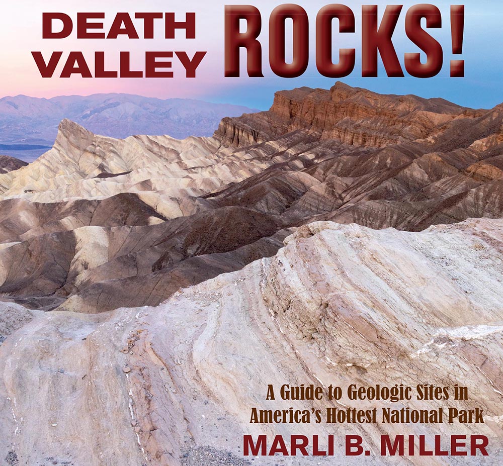
To that end, I recently completed a book called Death Valley Rocks! A guide to geologic sites in America’s hottest national park. It’s being published by Mountain Press and should be out in early July. The book covers 40 geologically amazing sites in the national park as well as the adjacent Amargosa Valley and will be full of color photos and maps –and (of course) many of my photos didn’t make the cut. Here are twelve of those outtakes, selected to present a general picture of Death Valley’s geology. You can click on any image to see it at a larger size.

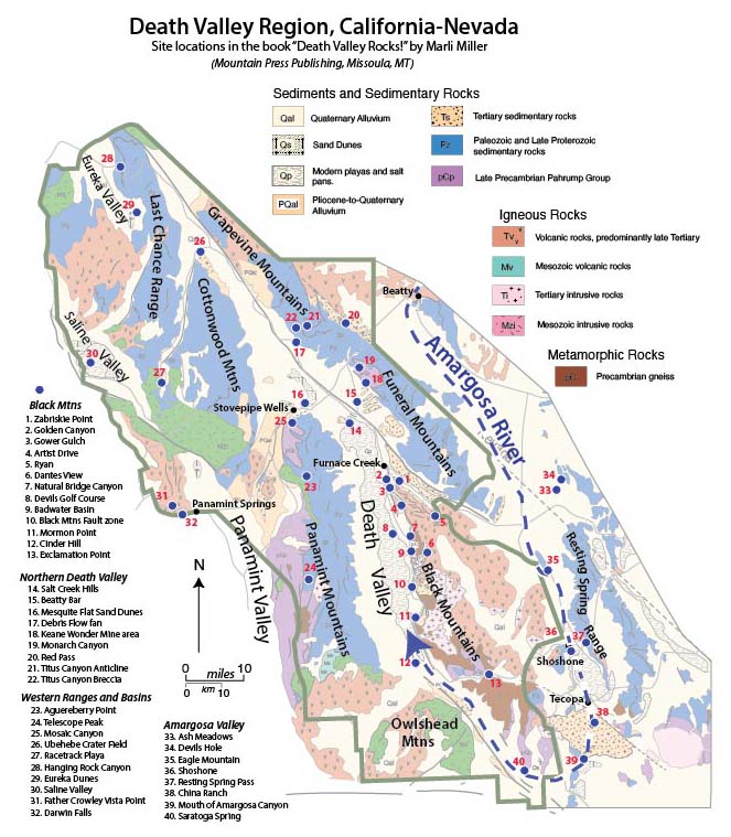
The first photos reflect Death Valley’s modern setting, an actively evolving basin in the southwestern part of the Basin and Range Province. The valley is the terminus of the Amargosa River, shown as the heavy dashed blue line resembling a giant fishhook in the map. The river starts just north of Beatty, Nevada, and flows southward about a 100 miles through the towns of Shoshone and Tecopa before turning northward to empty into Death Valley. Without an outlet, all the water that reaches the floor of Death Valley stays there until it evaporates. As it evaporates, the water precipitates salt, producing a magnificent salt pan that is broken by myriad polygonal shrinkage cracks.

Newly precipitated salt and flooded salt pan near Badwater (240108-01)

In August of 2023 Hurricane Hilary dropped 2.2 inches of rain on Death Valley, more than the area gets in a typical year. It flooded the valley floor to depths close to a foot in places, enough to float a kayak. Folks called it the “return of Lake Manly” –the name of the lake that filled the valley during the Pleistocene Epoch (Ice-Age). Sometime between 186,000-120,000 years ago, Lake Manly reached depths greater than 500’. You can see shorelines from glacial Lake Manly clinging to the front of the Black Mountains alongside the eastern side of the salt pan and a beautiful gravel spit along the Beatty Cut-off road.

Shoreline deposits of Glacial Lake Manly at Badwater –they show up as the horizontal deposits partway up the mouhtain 231123-36)
Alluvial fans and wineglass canyons along the western front of the Black Mountains (SrA-14)

The Black Mountains rise more than a mile above the valley floor along a fault zone that shows all the hallmarks of recent, extension-related, movement. These features include fault scarps and wineglass canyons –not to mention the straight and incredibly abrupt transition from valley floor to steep mountain front. While driving the Badwater Road, which winds around the alluvial fans along the base of the mountains, you have to swerve to avoid running into a mountain! 

Not only does uplift along the Black Mountains Fault Zone create a spectacular mountain front, but it also causes the range to tilt gently eastward into adjacent Greenwater Valley, resulting in an asymmetric range called a “tilted fault block”. Similarly, the Panamint Range, which borders Death Valley on its west side, forms a tilted fault block that rises steeply behind an extensional fault on its west and tilts gently eastward into Death Valley. These ranges, and other tilted fault blocks typify much of the Basin and Range Province, which extends from the Sierra Nevada in eastern California across Nevada to Salt Lake City in Utah. The faulting not only controls the landscape’s shape but also its climate. Death Valley’s desert conditions result from its location in the rainshadow of these uplifted mountain ranges. Winds off the Pacific Ocean have to rise over the intervening mountains before reaching Death Valley, cooling and losing their moisture in the process. 

Oblique striations (parallel to black line) on frontal fault surface along Artist Drive. (181101-12e)

In this part of the Basin and Range, much of the faulting is related to the Eastern California Shear Zone, which like the San Andreas fault to the west, expresses the side-by-side motion of the North American-Pacific plate boundary. Death Valley itself is being pulled apart by right-lateral motion along the overlapping Northern Death Valley-Furnace Creek Fault Zone and the Southern Death Valley Fault Zone. Even the Black Mountains Fault Zone, generally regarded as simply a normal fault, shows clear evidence for oblique motion. You can see oblique slickenlines (parallel to the black line on the photo above) on a giant exposure of the fault surface 2.5 miles along the Artist Drive loop.

It’s within this setting of strike-slip faulting and tilted fault blocks that visitors can experience an incredible array of geologic features. And because it’s so dry, everything is incredibly visible!  Besides the vast salt pan covering much of the valley floor and the features related to active faulting, Death Valley hosts sand dunes, alluvial fans, isolated playas, badlands, incredible canyons, even recently erupted volcanoes.

Aerial view of the Ubehebe Crater Field (Ig-108)

Granted, the volcanoes are small –but like the faulting, they speak to Death Valley’s modern activity.  Near the north end of the park, the Ubehebe Crater field formed by explosions resulting from the interaction of rising basaltic magma and groundwater just 2100 years ago. With the incredibly slow weathering rates of the dry desert climate, the crater field looks almost brand new. In the southern part of the valley, a cinder cone that’s somewhere around 100,000 years old is broken and offset several hundred meters by the southern Death Valley fault zone. Both these features are easily accessed by car.

Mesquite Flat sand dunes (181109-39)

Besides the fans and the volcanic features and the salt flats and everything else, I have to say that I’m partial to the sand dunes. When the light’s right, you can take photos almost randomly and come away with nice images. And there’s a good story behind the sand dunes: they form only in those places that have not just wind and a good supply of fine sediment, but also where there’s some type of windblock, so the deposited sand doesn’t blow away. At Mesquite Flat, the dunes periodically get inundated with water, so they contain flat areas in-between the actual dunes that are covered with beautifully mud-cracked fine sediment. If you make the trip to the Eureka Dunes, you’ll see the tallest sand dunes in the state –and if the conditions are right, they’ll sing like the low notes of a cello!

Each modern feature has countless variations. There are 5 separate dune fields, for example, and a different alluvial fan at the mouth of almost every canyon. On the west side of the valley, most of the fans merge into a single bajada, which itself varies depending on the nature of the mountain behind it. The canyons themselves are certainly variable, depending on a host of factors, not the least of which is the bedrock.

Folded marble of the Pahrump Group in Monarch Canyon (3174-29m)

It’s the bedrock that tells the area’s incredibly rich geologic history, which stretches deep into the Precambrian, before the poorly understood Yavapai mountain building event some 1.7 billion years ago. Since then, sedimentary rocks of the Pahrump Group recorded the assembly and breakup of the supercontinent Rodinia from about 1.2 to about 600 million years ago –and more than 20,000 feet of sedimentary rock overlie those, marking the transition to, and evolution of, a shallow ocean off the edge of North America’s western coastline.

Glacial dropstone in laminated siltstone of the Kingston Peak Fm of the
Pahrump Group. (211120-16)

Three geologic eras mark time after the Precambrian: the Paleozoic (539-252 million years ago), Mesozoic (252-66 m.y.), and Cenozoic (66 m.y. to present) eras and they roughly coincide with three main stages of Death Valley’s geologic history. At its simplest, the region accumulated the great

thicknesses of sedimentary rock during the Paleozoic; it was deformed by compressional mountain-building during the Mesozoic, and then by extensional mountain-building during the Cenozoic. While the boundaries between those Eras, which are defined by changes in fossil assemblages brought on by mass extinction events, don’t coincide exactly, they provide a framework.

Depending on where you are in Death Valley, you can see the effects of the compressional mountain-building. In the northwest part of the park, you can see folding and faulting in the Last Chance Thrust system in Hanging Rock Canyon, which was active at the end of the Paleozoic; in the Funeral Mountains, you can see rocks of the Pahrump Group folded and metamorphosed about 165 million years ago during the middle of the Mesozoic Era. The metamorphism was so hot that some of the rocks even melted.  At the mouth of Titus Canyon, you can see cliffs of Paleozoic limestone that are completely upside down. At Racetrack Playa, you can see an equivalent rock that’s folded and metamorphosed AND intruded by granitic rock. The granites are part of the Hunter Mountain Batholith, a harbinger of the Sierra Nevada granites.

Folding and faulting of Paleozoic rock in the Last Chance Thrust System (HangingRockPan2)

From studies of rocks’ isotopic records, we know that the earliest crustal extension in Death Valley likely occurred near the very end of the Mesozoic. However, the first visual evidence of crustal extension comes from the Titus Canyon Formation, deposited 37-30 million years ago.  If you drive to Red Pass on the Titus Canyon Road, you’ll see sedimentary breccias beneath sandstone and conglomerate. The breccias were deposited next to topographically high areas, possibly as talus, and the sandstone and conglomerate were formed in a steep-gradient river system.

Normal faults terminating downward at the Badwater Turtleback detachment fault. (140426-26)

But with volcanic rocks of the lowest part of the Artist Drive Formation, erupted about 14 million years ago, Death Valley’s most recent period of extension began. Most of the activity focused on today’s Black Mountains. Within the next few million years, the turtleback shear zones, parts of the Amargosa Chaos, and the Furnace Creek fault zone became active, as well as emplacement of the Smith Mountain Granite, Willow Spring Pluton and the Shoshone Volcanics. Additionally, the Furnace Creek Basin took shape along the southwest side of the Furnace Creek fault zone. It hosted much of the Artist Drive Formation, the Furnace Creek Formation, and much of the overlying Funeral Formation. Generally considered a precursor to modern Death Valley, the Furnace Creek Basin was initially a throughgoing river and playa system that evolved into closed basin somewhat like Death Valley about 3.5 million years ago.

10 million year old tuff at Resting Spring Pass. Black stripe is a zone of volcanic glass. (151128-23)

Sometime after 3.5 million years ago, the drainage into the Furnace Creek Basin was disrupted by the rising Black Mountains, which gave shape to today’s landscape. This event is recorded as alluvial fan deposits derived from the growing Black Mountains found in the upper part of the Furnace Creek Formation and the Funeral Formation. Even younger stages of the newly evolving landscape are recorded in younger alluvial fan deposits at Mormon Point and Natural Bridge Canyon. The Black Mountains now rise to elevations above 6000′, while the bottom of the valley floor is more than 10,000′ deep.

View of Death Valley and Copper Canyon Alluvial fan (2149-16)

All photos are available for free download at Geologypics.com (use the search function and type in the corresponding file number). You can find 5000+ other images there, all searchable, and all freely downloadable for personal or educational uses.

Mountain Press’s website is https://mountain-press.com/

Post Navigation