Death Valley… I can’t wait! Tomorrow this time, I’ll be walking on the salt pan with my structural geology students, gawking at the incredible mountain front –and soon after that, we’ll be immersed in fault zones, fractures, and fabrics!
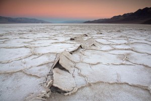
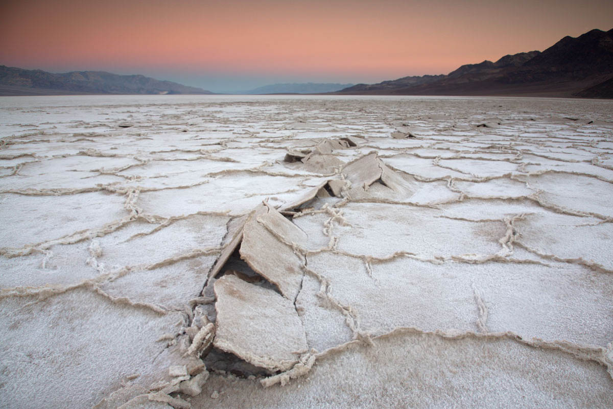
Death Valley salt pan at sunrise.
Death Valley presents incredible opportunities for all sorts of geology, especially geologic time; you can look just about anywhere to see and feel it. Take the salt pan. It really is salt –you can sprinkle it on your sandwich if you want. It’s there because the valley floor periodically floods with rainwater. As the rainwater evaporates, dissolved salt in the water precipitates. And between 186,000-120,000 years ago, Death Valley was filled by a 600′ deep lake, which evaporated, leaving behind more salt. Before that, more shallow flooding and more lakes.
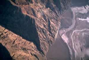
Aerial view of faulted front of the Black Mountains.
But the basin is more than 4 miles deep in some places! It’s not all salt, because there are a lot of gravel and sand deposits, but a lot of it is salt. That depth speaks to geologically fast accumulation rates, because it all had to accumulate since Death Valley formed –probably in the last 2 or 3 million years. But still, 2 or 3 million years is way past our realm of experience.

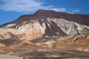
Hiker in the Funeral Mountains of Death Valley.
To really go back in geologic time though, you need to look at the mountains. Most of the mountains contain Upper Precambrian through Paleozoic sedimentary rock, most of which accumulated in shallow marine environments. There’s a thickness of more than 30,000 feet of sedimentary rock exposed in Death Valley! Deposited layer after layer, you can only imagine how long that took.
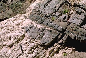
We can measure the thickness of the rock because it’s no longer in its original horizontal position. The ones in the photo above were tilted by faulting –which occurred during the period of crustal extension that formed Death Valley today. The rocks in the photo below were folded –by a period of crustal shortening that took place long before the modern extension. The folding occurred during the Mesozoic Era –more than 65 million years ago.

Aerial view of Titus Canyon Anticline.
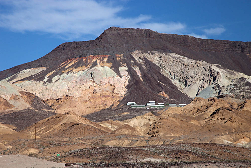
Above the Upper Precambrian to Paleozoic rock are thousands of feet of volcanic and sedimentary rock, tilted and faulted, but not folded. They reveal many of the details of the crustal extension that eventually formed today’s landscape. For example, the photo below shows Ryan Mesa in upper Furnace Creek Wash. In this place, the main period of extensional faulting predates the formation of modern Death Valley. Look at the photo to see that faulting must have stopped before eruption of the dark-colored basalt flows. Notice that there has to be a fault underneath the talus cones that separates the Artist Dr. Formation on the left from the Furnace Creek Formation on the right. Because the fault does not cut the basalt though, it has to be older. Those basalts are 4 million years old, older than modern Death Valley. –And that’s the old mining camp of Ryan perched on the talus.
Angular unconformity at Ryan Mesa: 4 Ma basalt flows overlying faulted Artist Drive (left) and Furnace Creek (right) formations.
And beneath it all? Still older rock! There’s some 5,000 feet of even older Precambrian sedimentary rock, called the “Pahrump Group” beneath the 30,000 feet of Upper Precambrian and Paleozoic rock–and below that, Precambrian metamorphic rock. It’s called the “basement complex” because it’s the lowest stuff. Here’s a photo.
pegmatite dike and sill intruding gneiss
The pegmatite (the light-colored intrusive rock) is actually quite young–I think our U-Pb age was 55 Ma –but the gneiss is much older, with a U-Pb age of 1.7 billion years. Billion! Forget about the U-Pb age though. These rocks form miles beneath Earth’s surface –and here they are, at the surface for us to see. Without knowing their age, you’re looking at deep geologic time because of the long period of uplift and erosion required to bring them to the surface. And it happened before all those other events that described earlier.
THIS is why, when visiting Death Valley, you need to explore the canyons and mountains –not to mention the incredible views, silence, stillness…
Some links:
Geologic map of Death Valley for free download
Slideshow of Death Valley geology photos
–or better yet, type “Death Valley” into the geology photo search function on my website!
Posted in
Geologic Time,
Geology,
geophotography,
mountains,
national parks,
photography,
young earth creationism and tagged
aerial photo,
alkali,
Anticline,
arid,
Basin and Range,
California,
creationism,
Death Valley National Park,
deep time,
desert,
desert mountains,
Earth Science,
geologic history,
geologic history of Death Valley National Park,
geologic time,
geology,
landscape,
mountains,
national parks,
Paleozoic,
Precambrian,
recumbent fold,
salt pan,
sedimentary rock,
stratigraphy