geologictimepics

Geology and Geologic Time through Photographs

Archive for the tag “creationism”

Conglomerate!

A trip to Death Valley over Thanksgiving two weeks ago reignited all sorts of things in my brain, one of which being my love of conglomerate. Honestly, conglomerate HAS to be the coolest rock!

151128-3

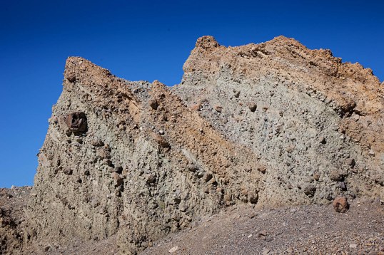
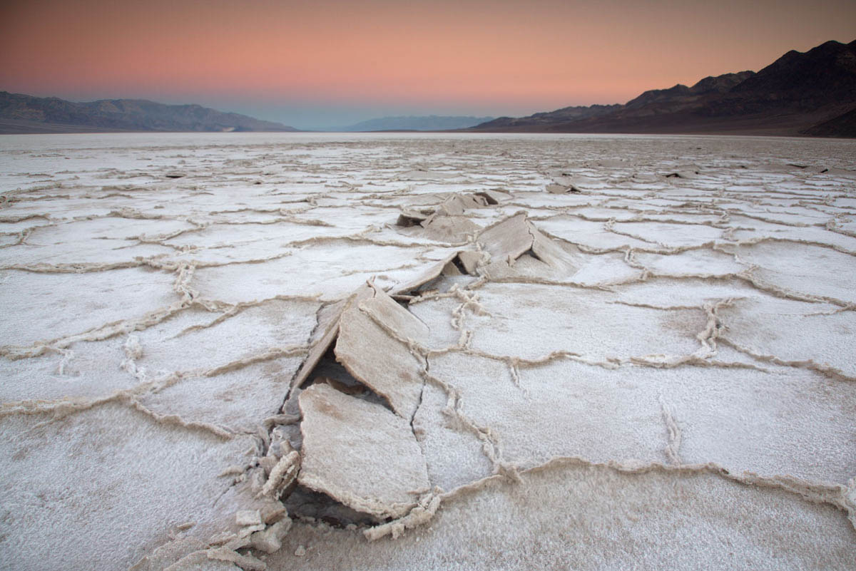
Tilted conglomerate in Furnace Creek Wash, Death Valley.

Just look at this stuff! Just like any good clastic sedimentary rock, it consists of particles of older rock–but with conglomerate, you can easily see those particles. Each of those particles opens a different door to experiencing deep geologic time.

As an example, look at the conglomerate below, from the Kootenai Formation of SW Montana. It contains many different cobbles of light gray and dark gray quartzite and pebbles of black chert. The quartzite came the Quadrant Formation and chert from the Phosphoria Formation. So just at first glance, you can see that this conglomerate in the Kootenai contains actual pieces of two other older rock units.

3528-38lr

Conglomerate of the Kootenai Formation, SW Montana.

But consider this: The Quadrant formed as coastal sand dunes during the Pennsylvanian Period, between about 320-300 million years ago and the Phosphoria chert accumulated in a deep marine environment during the Permian, from about 300-250 million years ago. The Kootenai formed as river deposits during the early part of the Cretaceous Period, about 120 million years ago. All those are now together as one.

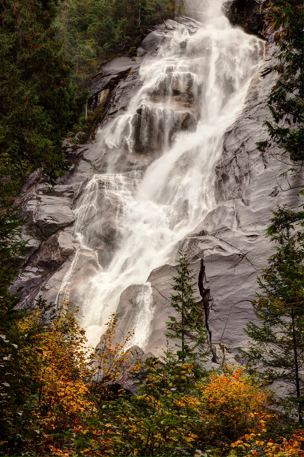
Similar to the modern river below (except for the glaciers), the Kootenai rivers transported gravel away from highlands –the highlands being made of much older rock that was uplifted and exposed to erosion. That older rock speaks to long gone periods of Earth history while the gravel speaks to the day it’s deposited.

120709-123

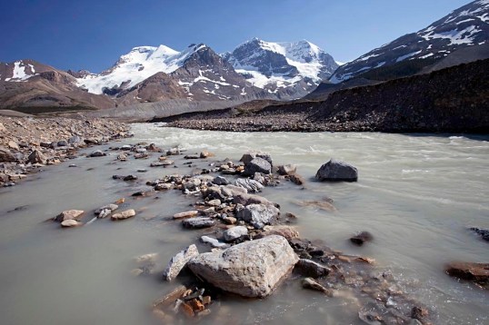
Athabasca River in Jasper National Park, Alberta

But this is where my head starts to spin: the modern gravel is made of rounded fragments of old rock –so when you look at a conglomerate, you glimpse at least two time periods at once: you see the conglomerate, which reflects a river or alluvial fan –or any environment near a bedrock source– and you also see the particles, which formed in even older environments.

And it gets worse –or better. What happens when you see a conglomerate eroding? The conglomerate is breaking up into modern sediment, which consists of pieces of older sediment –that at one time was modern sediment that used to be older sediment?  Look at the pebbles below. I keep them in a rusty metal camping cup on a table in my office.

151209-4

“Recycled” pebbles of the Kootenai Formation.

These stream pebbles eroded out of the Kootenai conglomerate. So… they’re simultaneously modern stream pebbles and ancient ones –AND… they originated as the Quadrant and Phosphoria Formations. Four periods of time, spanning 300 million years, all come together at once.

And if that’s not enough, those conglomerates in Death Valley? They  contain particles of… conglomerate! Look! The arrow in the left photo points to the boulder of conglomerate on the right. If you click on the photos, you can see them enlarged.

All those particles, which are now eroding and becoming modern sediment, were yesterday’s sediment. And the conglomerate boulder? It too is becoming “modern sediment” and it too was “yesterday’s sediment” when it was deposited on an alluvial fan with the rest of the material. However, it goes a step further: its pebbles and cobbles were both “modern” and “yesterday’s” sediment at a still older time. And before that? Those pebbles and cobbles eroded from even older rock units, some of which date from the Cambrian, about 500 million years ago.

For fun, here’s a photo of another conglomerate boulder.

Conglomerate clast in conglomerate

Conglomerate boulder in conglomerate of the Furnace Creek Formation, Death Valley, CA.


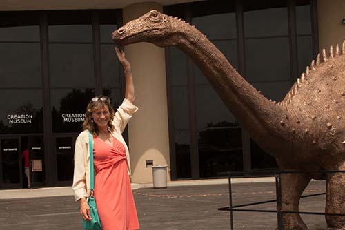
I can’t help but wonder how Young Earth Creationists would deal with these rocks. Given their story of the Grand Canyon, in which the Paleozoic section was deposited during early stages of “The Flood” and the canyon was carved during the later stages (they really do say that too!), they’d probably roll out that same blanket answer: The Flood. End of discussion. No questioning, no wondering.

In my opinion, one of the beautiful things about geology is that we’re always questioning and wondering.


for more geology photos, please visit my website.


Death Valley National Park– Geology Overload!

Death Valley… I can’t wait! Tomorrow this time, I’ll be walking on the salt pan with my structural geology students, gawking at the incredible mountain front –and soon after that, we’ll be immersed in fault zones, fractures, and fabrics!

Death Valley salt pan at sunrise.

Death Valley salt pan at sunrise.

Death Valley presents incredible opportunities for all sorts of geology, especially geologic time; you can look just about anywhere to see and feel it.  Take the salt pan.  It really is salt –you can sprinkle it on your sandwich if you want.  It’s there because the valley floor periodically floods with rainwater.  As the rainwater evaporates, dissolved salt in the water precipitates.  And some 10,000 years ago, Death Valley was filled by a 600′ deep lake, which evaporated, leaving behind more salt. Before that, more shallow flooding and more lakes.

Aerial view of faulted front of the Black Mountains.

Aerial view of faulted front of the Black Mountains.

But the basin is more than 4 miles deep in some places! It’s not all salt, because there are a lot of gravel and sand deposits, but a lot of it is salt.  That depth speaks to geologically fast accumulation rates, because it all had to accumulate since Death Valley formed –probably in the last 2 or 3 million years.  But still, 2 or 3 million years is way past our realm of experience.

Hiker in the Funeral Mountains of Death Valley.

Hiker in the Funeral Mountains of Death Valley.

To really go back in geologic time though, you need to look at the mountains. Most of the mountains contain Upper Precambrian through Paleozoic sedimentary rock, most of which accumulated in shallow marine environments.  There’s a thickness of more than 30,000 feet of sedimentary rock exposed in Death Valley! Deposited layer after layer, you can only imagine how long that took.

We can measure the thickness of the rock because it’s no longer in its original horizontal position.  The ones in the photo above were tilted by faulting –which occurred during the period of crustal extension that formed Death Valley today.  The rocks in the photo below were folded –by a period of crustal shortening that took place long before the modern extension.  The folding occurred during the Mesozoic Era –more than 65 million years ago.

Aerial view of Titus Canyon Anticline.

Aerial view of Titus Canyon Anticline.

Above the Upper Precambrian to Paleozoic rock are thousands of feet of volcanic and sedimentary rock, tilted and faulted, but not folded. They reveal many of the details of the crustal extension that eventually formed today’s landscape.  For example, the photo below shows Ryan Mesa in upper Furnace Creek Wash.  In this place, the main period of extensional faulting predates the formation of modern Death Valley.  Look at the photo to see that faulting must have stopped before eruption of the dark-colored basalt flows.  Notice that there has to be a fault underneath the talus cones that separates the Artist Dr. Formation on the left from the Furnace Creek Formation on the right.  Because the fault does not cut the basalt though, it has to be older.  Those basalts are 4 million years old, older than modern Death Valley.  –And that’s the old mining camp of Ryan perched on the talus.

Angular unconformity at Ryan Mesa: 4 Ma basalt flows overlying faulted Artist Drive (left) and Furnace Creek (right) formations.

Angular unconformity at Ryan Mesa: 4 Ma basalt flows overlying faulted Artist Drive (left) and Furnace Creek (right) formations.

And beneath it all? Still older rock!  There’s some 5,000 feet of even older Precambrian sedimentary rock, called the “Pahrump Group” beneath the 30,000 feet of Upper Precambrian and Paleozoic rock–and below that, Precambrian metamorphic rock.  It’s called the “basement complex” because it’s the lowest stuff.  Here’s a photo.

pegmatite dike and sill intruding mylonitic gneiss

pegmatite dike and sill intruding gneiss

The pegmatite (the light-colored intrusive rock) is actually quite young–I think our U-Pb age was 55 Ma –but the gneiss is much older, with a U-Pb age of 1.7 billion years.  Billion!  Forget about the U-Pb age though.  These rocks form miles beneath Earth’s surface –and here they are, at the surface for us to see. Without knowing their age, you’re looking at deep geologic time because of the long period of uplift and erosion required to bring them to the surface.  And it happened before all those other events that described earlier.

THIS is why, when visiting Death Valley, you need to explore the canyons and mountains –not to mention the incredible views, silence, stillness…


Some links:
Geologic map of Death Valley for free download
Slideshow of Death Valley geology photos

–or better yet, type “Death Valley” into the geology photo search function on my website!

Rockin’ countertops–geologic time in our kitchens and bathrooms!

I stopped by a “granite” supplier yesterday –the kind of place that sells “granite” and “marble” slabs for countertops.  Besides the fact that almost none of the slabs were actually granite or marble, they were spectacular rocks that showed wonderful wonderful detail. I nearly gushed at the idea of taking a geology field trip there.  It’s local, and you seldom find exposures like this anywhere else!

slabs of polished rock at a "granite" warehouse --not sure if any of this is actually granite, but it all reflects geologic time.

slabs of polished rock at a “granite” warehouse –most of it’s not actually granite, but it all reflects geologic time.

Generally speaking, “granite” in countertop language means “igneous” or “metamorphic” –crystalline rocks that form miles beneath Earth’s surface and so require great lengths of time to reach the surface where they can be quarried.  When I first started this blog, geologic time with respect to igneous and metamorphic rocks were some of the first things I wrote about –it’s such pervasive and important stuff.

So the main point is that your friend’s kitchen with “granite” countertops surrounds you with geologic time every time you walk in there!

But check out that green polka-dotted rock on the right side of the photo.  Full of rounded cobbles –it’s a conglomerate, originating by sedimentary processes on Earth’s surface. Does it indicate great lengths of geologic time? A Young Earth Creationist might say it were a deposit of “the Flood” and end-of-story.

Here’s a closer look:

Polished conglomerate --individual cobbles are metamorphic rocks. The green color comes from the mineral chlorite.

Polished conglomerate –individual cobbles are metamorphic rocks. The green color of the background material comes from the mineral chlorite. That’s a penny (on the left) for scale.

The conglomerate is made of beautifully rounded cobbles and small boulders that are almost entirely metamorphic in origin.  Most of them are gneisses, which form at especially high grades of metamorphism, typical of depths greater than 8 or 10 miles!  After a (long) period of uplift and erosion, the rock was exposed to erosion, gradually breaking into fragments, which eventually became these rounded cobbles, and ended up in the bottom of a big stream channel or on a gravel bar somewhere.

But that’s not the end of the story, because this deposit of rounded cobbles itself became metamorphosed –so it had to get buried again. We know that because the rock is pervaded by the mineral chlorite, which gives the rock its green color.  Chlorite requires metamorphism to form.  Granted, the rock isn’t highly metamorphosed –there’s no metamorphic layering and chlorite forms at low metamorphic temperatures– but it’s metamorphic nonetheless, typical of depths of a few miles beneath the surface.

And if you look even closer, you can see some of the effects of the reburial pressures: the edges of some of the cobbles poke into some of the other ones. This impingement is a result of the stress concentrations that naturally occur along points of contact.  The high stress causes the less soluble rocks to slowly dissolve into the other, more soluble rock.

cobbles, impinging into each other. Stars on right photo show locations.

cobbles, impinging into each other. Stars on right photo show locations.

I’m already jealous of the person who’s going to buy this slab of rock. It tells a story that begins with 1) metamorphic rock forming deep in the crust, then 2) a long period of uplift and erosion to expose the rocks, then 3) erosion, rounding, and deposition of the metamorphic cobbles, 4) reburial to the somewhat shallow depths of a mile or two–maybe more, 5) more uplift and erosion to expose the meta-sedimentary deposit, 6) Erosion by human beings.

And me? Personally, I’d like to make a shower stall or a bathtub out of this rock –can you imagine???


Some links you might like:
a blog I like that’s about science and creationism
another blog about an ancient Earth and deep time
my original song “Don’t take it for Granite“. (adds some levity?)
Geology photos for free download.


Geologic Irony in Cincinnati and northern Kentucky! Deep geologic time everywhere –and the absurd denial of the Creation Museum.

It’s been awhile since I’ve posted –too many things have been happening, like the end of fall term, other deadlines, and of course, coming down with a bad cold!  But I did manage to visit Cincinnati, Ohio for Thanksgiving.  I’m originally from Cincinnati, and I always enjoy going back.

Ordovician shale and limestone along I-75 in northern Kentucky; downtown Cincinnati, Ohio occupies the background

Ordovician shale and limestone along I-75 in northern Kentucky; downtown Cincinnati, Ohio occupies the background

Besides visiting with old friends, one thing I love about the Cincinnati-Northern Kentucky area, is the incredible wealth of marine fossils in its rocks, which date from the Ordovician Period, some 475 million years ago.  It’s always amazing to me that I can, almost at random, pick up a rock and see the remains of critters that were actually alive so long ago.  It fills me with a sense of wonder, mystery, and awe that I’ll never be able to explain –and it demonstrates to me how I’m a part of the earth –not apart from it.

marine fossils in Ordovician limestone from northern Kentucky --you can see mostly brachipods (they look sort of like clam shells) and bryozoa (branching coral-like things) in this rock.

marine fossils in Ordovician limestone from northern Kentucky –you can see mostly brachipods (they look sort of like clam shells) and bryozoa (branching coral-like things) in this rock.

Really, these fossil-rich limestones are just about EVERYWHERE!  Even many of the stone buildings and walls that you can see throughout Cincinnati, are full of Ordovician marine fossils.

And what a wonderful setting!  The Ohio river cuts through its original floodplain, now perched a couple hundred feet above the river.  That’s actually a whole story in itself, because today’s Ohio River formed as a result of the continental ice sheet advancing across northern Ohio, and blocking the courses of several north-flowing rivers, such as the Kentucky and Licking Rivers.

Looking up the Ohio River from the air --near where Ohio, Kentucky, and Indiana meet.

Looking up the Ohio River from the air –near where Ohio, Kentucky, and Indiana meet.

And then there’s the Creation Museum in northern Kentucky, perched on the old river terrace above bedrock of fossil-rich Ordovician limestone and shale.  One look at the two photos below and you can see what they’re all about.

The explanation for fossils according to the Creation Museum (on the left), and a diorama depicting a human being coexisting with a dinosaur on the right.

The explanation for fossils according to the Creation Museum (on the left), and a diorama (on the right) depicting a human being coexisting with a dinosaur.

According to “The Museum”, fossils “were formed by Noah’s Flood (~4,350 years ago) and its aftermath” –and dinosaurs really did coexist with humans.  In fact, I read that before Adam and Eve ate their apple, T Rex dinosaurs were actually vegetarian.

But don’t take it from me that those limestones are actually very old (100s of millions of years, as opposed to 4,350 years).  Take a look at a geologic map.  The Cincinnati-Northern Kentucky area is underlain by more than 1000 feet of limestone and shale –and if you travel eastward or westward, you encounter 1000’s more feet of marine sedimentary rock that sit on top the Ordovician.  And the fossils in those rocks show a change with time, called evolution.  If you think about it, you’re looking at a long long time to deposit –and preserve–all that sediment.

Geologic map of the United States; the area around Cincinnati is enlarged.  "CM" shows the approximate location of the Creation Museum.

Geologic map of the United States; the area around Cincinnati is enlarged. “CM” shows the approximate location of the Creation Museum.

The Creation Museum tells us that all that sediment was deposited by “the flood”.  Never mind that very little of the rock contains particles even as big as a sand grain.  Below is a photo of a real flood deposit.  As you can see, the deposit is very coarse-grained!  It’s coarse-grained because large floods are very energetic and transport large particles.

Coarse-grained sediment, deposited by one of the Missoula Floods in Oregon, some 15,000 years ago.

Coarse-grained sediment, deposited by one of the Missoula Floods in Oregon, some 15,000 years ago. The exposure is about 20 feet high.

So the Creation Museum is asking you to BELIEVE that 1000s of feet of limestone were deposited by a flood, as well as the 1000s of feet of older rocks and 1000s of feet of younger rocks I didn’t even mention.  They also want you to believe that T. Rex was a vegetarian who lived alongside Adam and Eve.

But here’s what really bothers me: by misrepresenting science and promoting its own skewed interpretation of the bible as the literal Truth, the “museum” discourages people from looking at these beautiful rocks with a sense of wonder, mystery, and awe.  It discourages them from inquiring into how those rocks really formed.  The museum discourages people from learning important things about our planet and from forming their own views on the world.

Me petting a dinosaur at the Creation Museum

Me petting a dinosaur at the Creation Museum.


Type “Ordovician” into the search for a few more photos of Ordovician fossils.

Cloudy afternoon waving at the Stawamus Chief–lovely spot and deep time

My friend Jessica and I skipped out from the Geological Society of America meeting in Vancouver last weekend to go visit the Stawamus Chief –a gigantic granite monolith near the town of Squamish.  What a lovely place –and what a great respite from the craziness of a big meeting in a big city!

I don’t want to repeat myself too much, because I wrote about this in an earlier post–but just the fact that granite is exposed at the surface requires deep time –inconceivably great lengths of time.  That’s because granite forms from a molten state by slow cooling and crystallizing far beneath Earth’s surface –10 km or more usually –and THAT means the rock had to get uplifted and exposed at Earth’s surface through processes that we humans perceive as time-consuming–on the order of millions of years.  Additionally, all the rock that used to be above the granite had to get eroded away in the process.

Stawamish Chief rises some 2000 feet above us --a trail leads to the top.

And Shannon Falls is right there too–Amazing!  It sprays about 1000′ down a series of cliffs–and allows a good, up-close look at the granite.  It’s actually granodiorite –which is a lot like granite except that it contains a lot more plagioclase, as opposed to alkali, feldspar.

Shannon Falls, near the bottom of its 1000' drop.

Shannon Falls, near the bottom of its 1000′ drop.

So… the granite speaks to great amounts of time… and the waterfall–it speaks to the changing landscape.  It falls down scoured and smoothed cliffs because the whole area has been shaped by glacial erosion.  Not long ago, this area was under ice!  (Longer though, than the beginning of planet Earth according to the Young Earthers).  You can see some wonderful glacial polish and striations on fluted granite along the highway between the Chief and the town of Squamish.

Glacially carved granite--right next to a large pull-out on the highway.

Glacially carved granite–right next to a large pull-out on the highway.


click here for some more photos of intrusive igneous rocks.

Crater Lake caldera, Oregon –some things happen quickly!

Crater Lake never ceases to amaze me.  It’s huge –some 6 miles (10 km) across, deep –some 1700 feet deep in parts –the deepest lake in the United States and 7th deepest on the planet– incredibly clear, and really really blue.  And for volcano buffs, one of the best places ever!

Crater Lake as seen from The Watchman.  Wizard Island, which formed after the caldera collapse, occupies the center of the photo.

Crater Lake as seen from The Watchman. Wizard Island, which formed after the caldera collapse, occupies the center of the photo.

Crater Lake is a caldera, formed when ancient Mt. Mazama erupted so catastrophically that it emptied its magma chamber sufficiently for the overlying part of the mountain to collapse downward into the empty space.  That was about 7700 years ago.  Soon afterwards, Wizard Island formed, along with some other volcanic features that are now hidden beneath the lake–and then over the years, the lake filled to its present depth.  It’s unlikely to rise any higher because there is a permeable zone of rock at lake level that acts as a drain.

Here’s one of the coolest things about the cataclysmic eruption: Not only was it really big, but it happened really fast.  We know it was big because we can see pumice, exploded out of the volcano, blanketing the landscape for 100s of square miles to the north of the volcano –and we can see the caldera.  We can tell it happened quickly because the base of the pumice is welded onto a rhyolite flow that erupted at the beginning stages of the collapse; the rhyolite was still HOT when the pumice landed on it!  You can see the welded pumice on top the Cleetwood Flow along the road at Cleetwood Cove.

pumice welded onto top of Cleetwood rhyolite flow at Cleetwood Cove.  Note how the base of the pumice is red from oxidation --and forms a ledge because it's so hard.

pumice welded onto top of Cleetwood rhyolite flow at Cleetwood Cove. Note how the base of the pumice is red from oxidation –and forms a ledge because it’s so hard.  Pumice blankets the landscape all around Crater Lake.

Crater Lake though, is so much more than a caldera –it’s the exposed inside of a big stratovolcano!  Where else can you see, exposed in beautiful natural cross-sections, lava flow after lava flow, each of which erupted long before the caldera collapse and built the original volcano? Within the caldera itself, these flows go back 400,000 years–the oldest ones being those that make up Phantom Ship –the cool little island (some 50′ tall) in Crater Lake’s southeast corner.

Phantom Ship, in Crater Lake's southeast corner, is made of the caldera's oldest known rock, at 400,000 years old.

Phantom Ship, in Crater Lake’s southeast corner, is made of the caldera’s oldest known rock, at 400,000 years old.

I can’t resist.  The caldera formed about 7700 years ago, incredibly recent in Earth history–incredibly recent in just the history of Mt. Mazama!  To a young earth creationist though, that’s 1700 years before Earth formed.  Now THAT’S amazing!


Click here if you want to see a Geologic map of Crater Lake.
Or… for more pictures of Crater Lake, type its name into the Geology Search Engine.  Or… check out the new Roadside Geology of Oregon book!

Lakes drying up in southeastern Oregon –geologically, very quickly

Lake Abert’s one of the coolest lakes in Oregon –in my opinion.  It’s got birds along its shoreline because it hosts a huge population of brine shrimp (which smell, by the way).  It has the brine shrimp because it doesn’t have any fish –and it doesn’t have fish because it’s an alkali lake in a closed basin, full of salt. The water that goes into this lake stays there, until it evaporates.  When it evaporates, it leaves behind more salt.

Birds along small creek that empties into Lake Abert, Oregon.

Birds along small creek that empties into Lake Abert, Oregon.

Over the past few years, the lake seems to be drying up faster than usual–which makes all the sense in the world because we’ve had less rainfall than usual over the past few years.  There’s still water, but it’s noticeably farther out into the “lake” than before.  That’s certainly fast.  We, as humans, can watch this lake dry up over just a few years.

salt deposits at Lake Abert, Oregon

salt deposits at Lake Abert, Oregon, looking northward.  Abert Rim, along the right side of the photo, is uplifted along a normal fault.

But think of what the lake was 20,000 years ago, at the height of the last glaciation!  The physiographic map below shows Lake Abert (along US 395) as part of the much larger Lake Chewaucan, which included the even larger Summer Lake basin to the west.  There’s all sorts of evidence for this earlier lake: old shorelines, deposits at elevations well above the modern lake, gravel bars.  And Lake Chewaucan was only one of many such Pleistocene, or “pluvial” lakes that occupied closed basins in the Oregon and Nevada Basin and Range.

Distribution of Pleistocene lakes in the southern Oregon Basin and Range.

Distribution of Pleistocene lakes in the southern Oregon Basin and Range.

Of course these ages do a “time-number” on me.  20,000 years is a short time, geologically.  So just yesterday, this region had many of these large large lakes –and in just a short time, they’ve dwindled to isolated remnants.  But in just the last 5 years, those remnants have dwindled even more.  It’s dramatic.  It’s frightening.

Odd too –those Young Earth Creation types think that planet Earth is younger than Lake Chewaucan!  And really?  Lake Chewaucan couldn’t have formed unless there was a basin there –and do you see the cliffs on the right (east) side of the lake?  That’s Abert Rim, uplifted by a big normal fault –which is what formed the basin.  So, the 2000′ of  uplift on this fault must be older than the lake, which is older than planet Earth!  Cool!


For more photos of Lake Abert, type “Lake Abert” into the geology search engine.
For information about the completely new (available in November, 2014) Roadside Geology of Oregon book.

Geologic history of the western United States in a cliff face in Death Valley National Park

Of the many geologic events that shaped the western United States since the beginning of the Paleozoic Era, five really stand out.  In approximate chronological order, these events include the accumulation of tens of thousands of feet of sedimentary rock on a passive margin, periods of compressional mountain building that folded and faulted those rocks during much of the Mesozoic–likely driven by the accretion of terranes, intrusion of subduction-related granitic rock (such as the Sierra Nevada) during the Jurassic and Cretaceous, volcanic activity during the late Cenozoic, and mountain-building by crustal extension during the late Cenozoic and continuing today.  This photo on the western edge of Panamint Valley in Death Valley National Park of California, captures all five.

View of canyon wall on west side of Panamint Valley in SE California --part of Death Valley National Park.  See photo below for interpretation.

View of canyon wall on west side of Panamint Valley in SE California –part of Death Valley National Park. See photo below for interpretation.

The photograph below shows an interpretation.  Paleozoic rock is folded because of the Late Paleozoic-early Mesozoic compressional mountain-building; it’s intruded by Jurassic age granitic rock, an early phase of Sierran magmatism that took place just to the west; the granitic rock is overlain by Late Cenozoic basalt flows, and everything is cut by a normal (extensional) fault.  And there is also a dike that cuts the Paleozoic rock –probably a feeder for the basalt flows.

Interpretation of top photo.

Interpretation of top photo.

So this is all nerdy geology cross-cutting relations talk –but here’s the point: in this one place, you can see evidence for 100s of millions of years of Earth History.  Earth is old old old!  THAT’S why I love geology!

And for those of you who crave geologic contacts?  This photo has all three: depositional, between the basalt and underlying rock; intrusive, between the Mesozoic granite and the folded Paleozoic rock; fault, the steeply dipping black line between the basalt and the Paleozoic rock.  Another reason why I love geology!


click here to see photos and explanations of geologic contacts.
or click here for a slideshow of Death Valley geology.

Geologic Time in a mountainside –the Wallowa Mountains from Joseph, Oregon

Joseph, Oregon is a wonderful place for geology.  The town sits right at the foot of the Wallowa Mountains in the northeastern corner of Oregon.  The mountains rise some 4-5000′ abruptly from the valley floor along a recently active normal fault.

The Wallowa Mountains rise along a fault zone just south of the town of Joseph.

The Wallowa Mountains rise along a fault zone just south of the town of Joseph.

In the mountains, you can see some bedrock relations that speak to great lengths of geologic time.  An erosional remnant of the Columbia River Basalt Group caps Sawtooth Peak in the photos below; it sits directly on granite of the Wallowa Batholith –and just a little bit south, on the next peak, the granite intrudes Martin Bridge Limestone!  So, from oldest to youngest, the rock units are the Martin Bridge Limestone, the Wallowa granite, the Columbia River Basalt.

Sawtooth Peak (right) capped by Columbia River Basalt.  Beneath it is granite of the Wallow Batholith --and off to the left, are the bedded rocks of the Martin Bridge Limestone.

Sawtooth Peak (right) capped by Columbia River Basalt. Beneath it is granite of the Wallowa Batholith –and off to the left, are the bedded rocks of the Martin Bridge Limestone.  See below for labels.

Rock units and contacts described in the text

Rock units and contacts described in the text

Never mind that we know the Martin Bridge Limestone is Triassic –so more than 200 million years old –and that the Wallowa Batholith formed at different times between 140 to about 120 million years ago –and that the basalt is about 16 million years old.  You can throw out radiometric dating, but even so, you’re looking at a great span of geologic time.  The limestone first had to be deposited, layer after layer –and then buried –and then intruded at a depth of 5-8 km by the granite –which THEN had to get uplifted to Earth’s surface so the basalt could flow over it.  After THAT, it all had to get uplifted to its present elevation along the normal fault just south of town and much of the basalt had to erode away.

Honestly, we have influential people in this country who spout off things like the Earth is only 6000 years old.  They also deny the overwhelming evidence for climate change.  I guess I should stop writing now before I get too worked up!


More photos of the Wallowas at Geologic Photography.

Glacially carved granite in Rocky Mountain National Park, Colorado

This landscape is so smooth and rounded that you can easily imagine the ice that must have covered it some 20,000 years ago.  And the ice must have been deep!  Look halfway up the mountain in the foreground on the left; it shows a distinct change of rock weathering akin to a bathtub ring–and the ring persists around much of the photo.  It likely marks the upper surface of the ice at maximum glaciation.

140809-94
Upper Glacier Gorge, a glacial cirque in Rocky Mountain National Park, Colorado.  View of the Spearhead (left) and McHenry’s Peak (just behind)

Like most landscapes, this one’s pretty young–and those glacial effects are even younger.  When compared to the age of the rock, it seems almost insignificant.  The granite bedrock, which is granite, is 1.4 billion years old!  Elsewhere in Rocky Mountain National Park, the granite intrudes even older metamorphic rock –1.7 billion years old.  Just .3 billion years older.  I think we forget that “just .3 billion years” is 300 million years –about the same length of time as the entire Paleozoic!  And the Pleistocene Epoch, during which the glaciers grew?  It started some 2 million and ended about 10,000 years ago

Granite sill intruding gneiss, Colorado.
1.4 billion year old granite intruding 1.7 billion year old gneiss in Rocky Mtn National Park.


images can be downloaded for free at marlimillerphoto.com

Post Navigation

%d bloggers like this: