Side Canyon Sand
A solitary raven flies overhead, the sound of its wings awakening me to the profound silence. Giant sandstone blocks, fallen from the cliffs above, litter the canyon floor. A broken tree trunk dangles silently over the canyon rim. All I hear are my footsteps, my breathing, and my noisy thoughts.
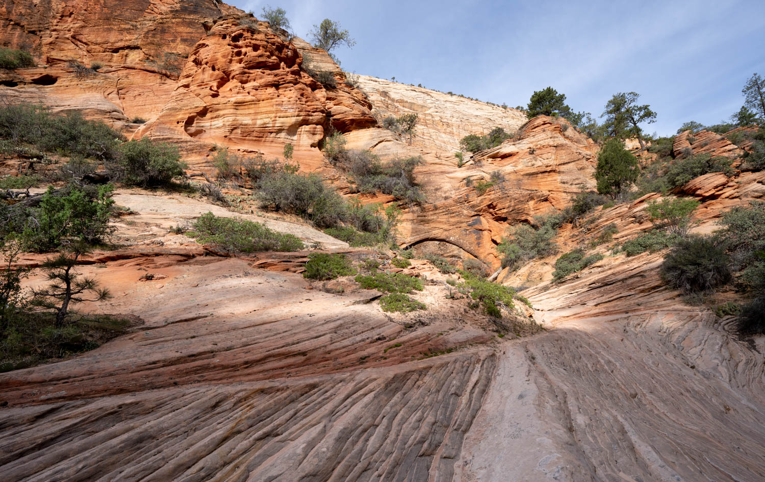
Just two hours ago, I joined a 20-minute line of cars waiting to enter Zion National Park and only a mile away, Utah State Highway 9 conveys thousands of cars each day. Too late to get a ticket to hike trails in Zion Canyon itself but determined to take some backcountry photographs, I stopped at this side canyon and started walking. The more I walked, the more the silence grew. Now, even my thoughts are quieting.
I haven’t felt this present or aware since I found myself alone in the midst of a sand dune field in Death Valley a few years ago. Just after sunset, the dunes were draped in shadows, and I put away my camera to watch the last sunlight fade from the nearby mountains. As I felt the temperature drop, I lingered. With no sound, no evidence of humanity in my view, and my mind free of distraction, planet Earth seemed to reveal itself –and part of me has remained there ever since.
The intimacy of this canyon differs from the expansiveness of Death Valley, but the silence is equally powerful. There, I looked out on a wide valley framed by mountains. Here, I’m confined by 100-foot walls of sandstone. There, I stood on top of a dune field alone with its countless changing lines and shapes. Here, I’m within a dune field, one made of the same blowing sand and changing lines and shapes, but now preserved as rock.
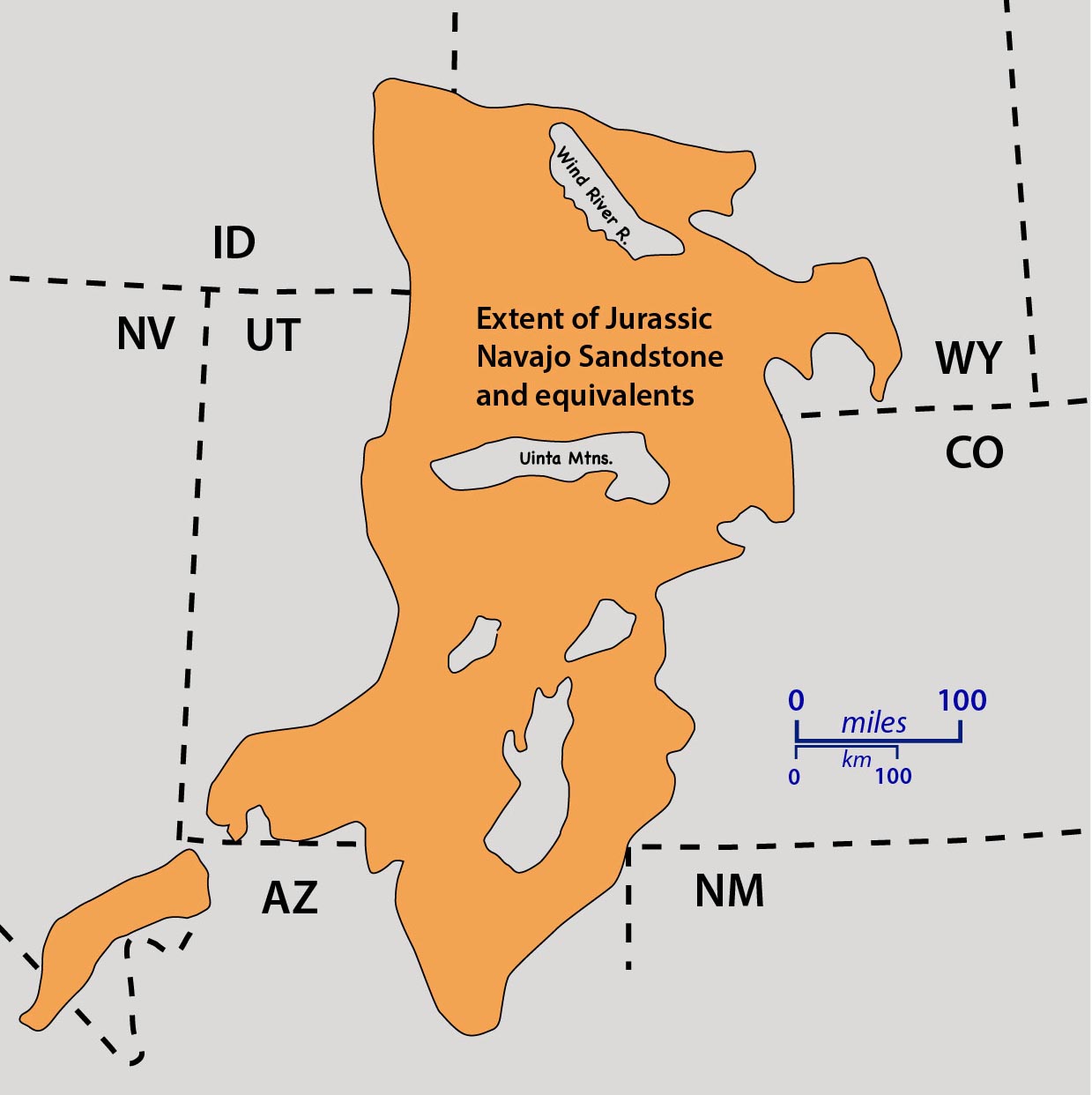
These dunes are part of the Navajo Sandstone, deposited during the Jurassic Period beginning about 195 million years ago. They form the 1000’ high cliffs in Zion as well as cliffs in Arches and Capitol Reef National Parks, and the White Cliffs of the Grand Staircase-Escalante National Monument. The Navajo Sandstone extends southward into Arizona while similar-aged dunes form the Aztec Sandstone in Nevada, the Glen Canyon Sandstone in Colorado, and the Nugget Sandstone in Wyoming and Idaho. The immensity of its area, literally a sea of sand called an “erg” staggers the imagination. The going estimate for its original size is that it covered roughly 850,000 square miles –larger than the all the dune fields of today’s Sahara Desert combined.
195 million years ago. Estimates vary for its age, from the very beginning of the Jurassic Period 201 million years ago to about 180 million years ago. Deposits like these are notoriously difficult to date because they preserve few if any diagnostic fossils, and being sedimentary, any dateable minerals in the sand would have formed in an older rock. However, in 2019, Judith Parrish of the University of Idaho and her colleagues dated the carbonate in lake deposits near the base of the formation at 200.5 and 195.0 million years.
The Jurassic Period itself, during which other sand seas came and went, river systems deposited the Morrison Formation in northeastern Utah and its cache of dinosaur bones, parts of the Rocky Mountains rose and the Atlantic Ocean began forming, lasted some 56 million years, from 201 to 145 million years ago. As a human being I can’t comprehend such time. I try and fail miserably. Sometimes I equate that time span to 56 years of my own life. 56 years ago, I was in elementary school and that was so long ago I scarcely remember it. I can’t help but smile at the absurdity.
Besides the Navajo Sandstone, Zion National Park also hosts the other Jurassic-age strata of southwest Utah. The Moenave and Kayenta Formations lie beneath the Navajo, marking an earlier time of increasing aridity that eventually led to these dunes. I drove through their red sandstones after entering the park and climbed through their layers while ascending the switchbacks to the long tunnel on highway 9. Just above the Navajo Sandstone lies red mudstone of the Temple Cap and Carmel formations, deposited when the land subsided below sea level. Erosional surfaces on top the Navajo and in-between these younger rocks indicate periods of emergence.
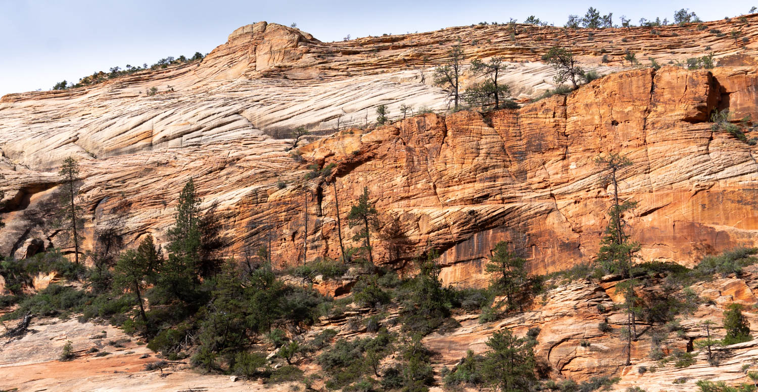
I snap a photo of the sandstone’s tell-tale cross-bedding, where myriad groups of bedding planes lie at varying angles to each other, each having formed on the side of a sand dune. Typically, sand blows over the dune crest, causing the dune to migrate and the sand to build up in sloping layers. Researchers measured the orientations of these cross beds to define wind flow patterns during this part of the Jurassic. They find that for most of the Navajo, the wind consistently blew from the north or northwest.
So these sand grains came from the northwest. With a handlens, I can see them, countless grains, all a very small size capable of being transported by wind. And they’re nearly all quartz. Of all the common rock-forming minerals, quartz is by far the most resistant to change. It can break into smaller pieces, but unlike most other minerals that eventually turn to clay, quartz stays quartz. Researchers suggest these grains came from a variety of sources like pre-existing sandstones found in Idaho, Montana, or even southern Alberta. There are certainly sandstones found in those places, and they’re older than the Navajo. The Cambrian ones deposited west of the so-called “Cordilleran Hingeline” are the thickest. Some 500 million years ago, they accumulated on continental crust that had been stretched thin by a period of rifting 100 or 200 million years before. They include the Tintic Formation, which today forms much of the 1000’ cliffs behind Ogden, Utah and the Gog Quartzite, which makes 4000’ foot cliffs behind Moraine Lake in Banff National Park of Alberta. At the same time those grains were being deposited, thinner accumulations of sand formed along the North American shoreline as the sea was rising over the subsiding land. These thinner sandstone bodies include the well-known Tapeats Sandstone of the Grand Canyon and the Flathead Sandstone of the Teton Range of Wyoming, both of which sit directly on the much older metamorphic and igneous rock that comprises North America’s foundation.
Of course, that leads to more questions. Those sandstone formations are exposed today, but they had to be exposed during the Jurassic Period if they provided the sand for the Navajo. If the Navajo is indeed 195 million years old, it would predate the known mountain building that occurred later in the Jurassic. Perhaps the Navajo is younger? Perhaps there was enough uplift before the main event to expose those rocks? Perhaps there was something else I’m not thinking of?
I love considering those possibilities, but it sends my thoughts back to my office and my computer. It makes me want to start looking things up and engaging with my colleagues who know more about this issue. But that can wait. I’m here in this canyon, not my office. So I look through my handlens at the sand grains once again and let my thoughts settle. I admire their tiny uniform sizes and shapes, and the glassy look of the quartz, frosted from being shuffled around by the wind. I ponder their numbers. Am I gazing at infinity? Surely the number of sand grains in my field of view could be counted. But what of the sandstone block I’m sitting on? The cliff? Zion National Park? The entire Navajo erg? What does infinity mean anyway? It’s a mathematical term that means endless. To my human brain, the numbers of grains are endless.
As is the length of time those sand grains have cycled through the rock record. Regardless of which sandstone bodies eroded to release it, they must have been older than the Navajo and had to receive their quartz grains from somewhere else. Eventually the process had to reach back in time until the original quartz crystals formed in a magma that cooled and crystallized into a rock, possibly miles below earth’s surface. What a journey! And the sandstone is eroding today, forming the spires and canyons we so adore in this part of the world. Just as important, it’s releasing sand grains to be blown around by the wind once again.
The sound of a commercial jet overhead makes me aware again of the silence, suddenly lost until after the plane passes. I realize I’ve been walking in this silence all morning. Suddenly grateful for my lack of trip preparation, I imagine my day had I managed to procure a permit to hike one of the more popular hikes in the park. I walk silently down the canyon and encounter the first hiker coming up. We smile in greeting and walk past each other as I realize my time alone in this canyon is ending. At the same time, I sense that part of me is still up there, drifting around with the loose sand.
References:
Kocurek, G., and Dott, R.H.Jr., 1983, Jurassic Paleogeography and paleoclimate of the central and southern Rocky Mountains Region. in, M.W. Reynolds and E.D. Dolly eds., Mesozoic Paleogeography of west-central United States. Rocky Mountain SEPM, p. 101-116.
Parrish, J.D., Rasbury, E.T., Chan, M.A., and Hasiotis, S.T., 2019, Earliest Jurassic U-Pb ages from carbonate deposits in the Navajo Sandstone, southeastern Utah, USA: Geology, v. 47, p. 1015-1019, https://doi.org/10.1130/G46338.1
Photos: Each photo can be viewed large by clicking on it –and can be downloaded freely from my photo site: Geologypics.com by typing the stock number into the search. (Or you can type a more general word or name–like “sandstone” or “Zion” and see a selection!


