Summarizing Washington State’s Geology –in 19 photo out-takes
Washington State displays such an incredible array of geologic processes and features that it makes me gasp –which is one reason why writing “Roadside Geology of Washington” was such a wonderful experience. I also got to do it with my long-time friend and colleague (and former thesis advisor at the University of Washington) Darrel Cowan. The book should be on bookshelves in mid-September –and I can’t think of a better way to celebrate than by summarizing Washington’s amazing geology with a bunch of out-take photos –ones that didn’t made it into the book or even to my editor. Like the photo below:

Mt. Baker, a glaciated stratovolcano in northern Washington State.
Mount Baker’s a stratovolcano that erupted its way through the metamorphic rock of the North Cascades. I took the photo from the parking lot at a spot called Artist’s Point –at the end of WA 542 –and my editor nixed it because I already had enough snow-capped volcanoes in the book.
On the cross-section below–which includes elements of Oregon as well as Washington, Mt. Baker is represented by the pink volcano-shaped thing labelled “High Cascades”. The following 15 or so photos illustrate most of the other features on the cross-section –so together, they illustrate much of the geology and geologic history of the state!

Generalized cross-section across Washington and Oregon.

Washington State and geologic provinces.
A quick note about organization: I’m separating the images according to their physiographic province. There are six in Washington: Coast Range, Puget Lowland, North Cascades, South Cascades, Okanogan Highlands, and Columbia Basin.
Coast Range:
As you can see in the cross-section, the Coast Range borders the Cascadia Subduction Zone and consists of three main elements: the Hoh Accretion Assemblage in yellow, Siletzia (called the “Crescent Formation” in Washington) in purple, and the post-accretion sedimentary rock in brown. Siletzia is the oldest. It was thrust over the Hoh Accretion Assemblage, which is still being accreted at the subduction zone. The post-Accretion sedimentary rocks were deposited over the top of Siletzia after it was accreted about 50 million years ago.
And here are some photos! Siletzia formed as an oceanic plateau and so is characterized by voluminous pillow basalts. In Washington, it crops out throughout the Coast Range, from the exposures at Cape Disappointment in the photo below to the Olympic Mountains. Outside of Washington, Siletzia extends southward to Roseburg, Oregon and northward onto Vancouver Island. It’s gigantic.

Pillow basalt of Siletzia near campground at Cape Disappointment, Washington.
The Hoh Assemblage makes all the great coastal landforms along the Olympic Coast –like these sea stacks at Second Beach near the coastal village of La Push. If you hit all the beaches, you can see most aspects of the assemblage –from submarine debris flow breccias (below) to turbidites to melange. What’s really amazing about the Hoh Assemblage is that it’s the stuff being accreted TODAY.

Formed in an Accretionary Wedge, the Hoh Assemblage contains these breccias that formed as submarine landslides. They now erode into sea stacks.
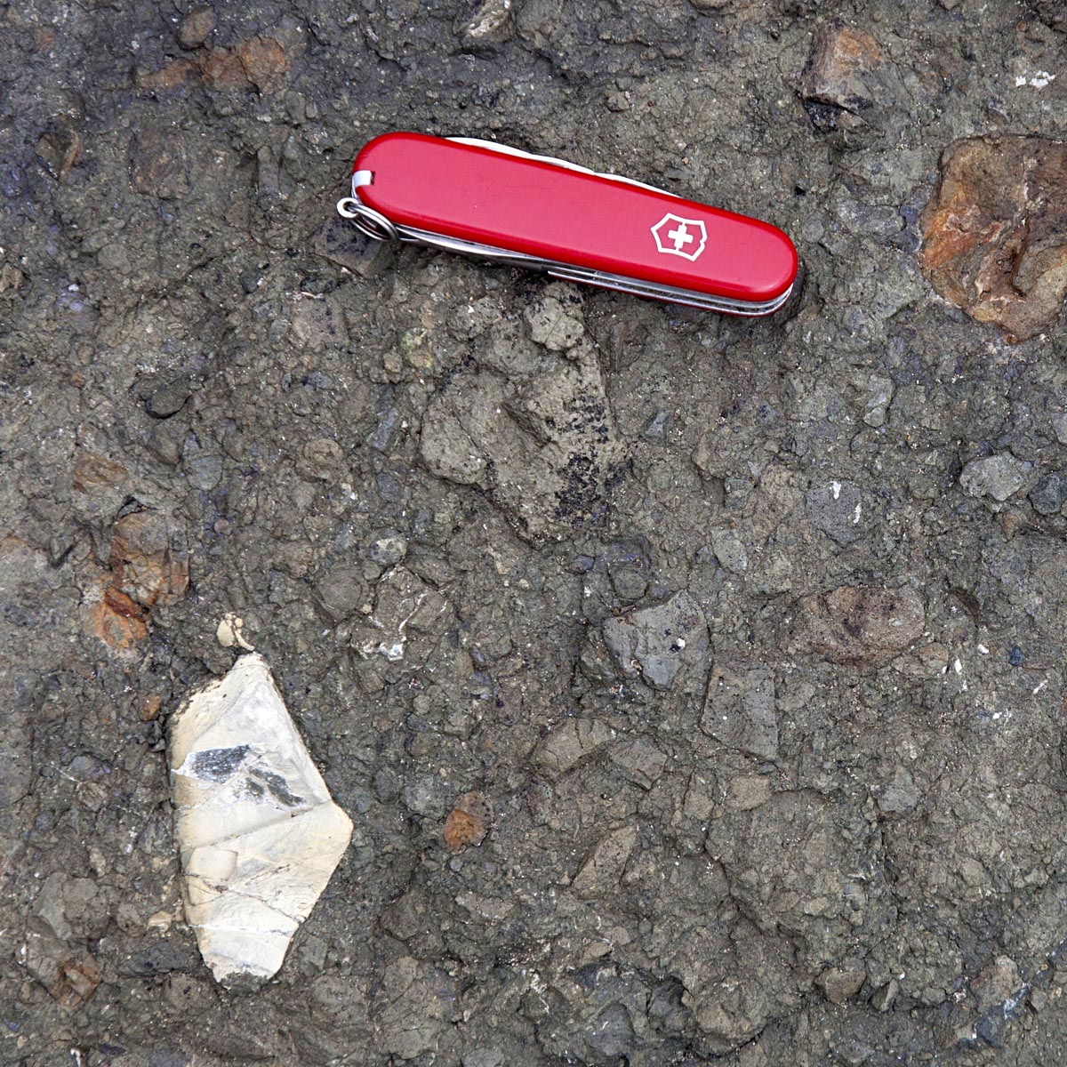
Brecciated Hoh Assemblage.
Here’s a close-up view of the breccia so you can see what it actually looks like. The white fragment is a random piece of limestone!
Then there’s all the rock deposited after accretion of Siletzia–the rock that covers most of the Coast Range and shows a fairly continuous record of deposition from the Eocene through the Miocene.

Montesano Formation along US12 outside of Aberdeen.
The Montesano Formation, for example, was deposited in a shallow marine environment during the Late Miocene. This roadcut just outside Aberdeen contains fossil clams.
Puget Lowland –the low area on the cross-section, just east of the Olympics.
Largely covered by water of Puget Sound, the Puget Lowland was buried by thousands of feet of ice during the Pleistocene. The most recent advance, called the “Vashon Stade” left the most obvious marks. It blanketed the area in till, fashioned drumlins, and eroded subglacial troughs, many of which are now locations of rivers, large lakes like Lake Washington, or the many narrow inlets that make Puget Sound so interesting.
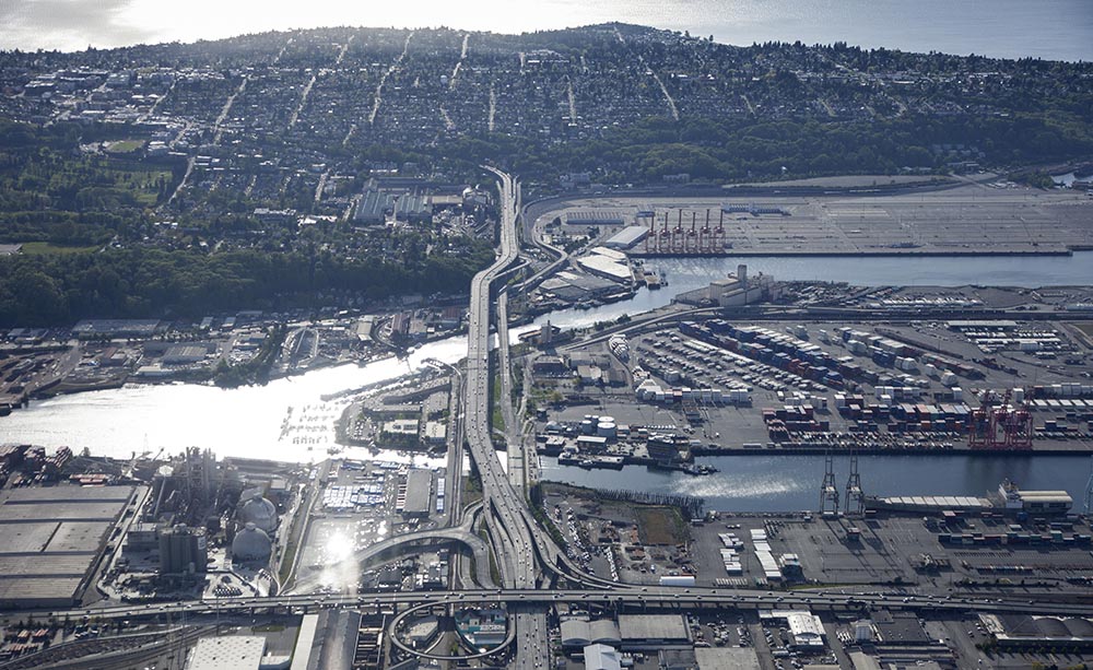
Aerial view across Harbor Island and mouth of Duwamish river to West Seattle, a glacial drumlin. The Duwamish occupies a partially submerged trough, eroded by subglacial meltwater.
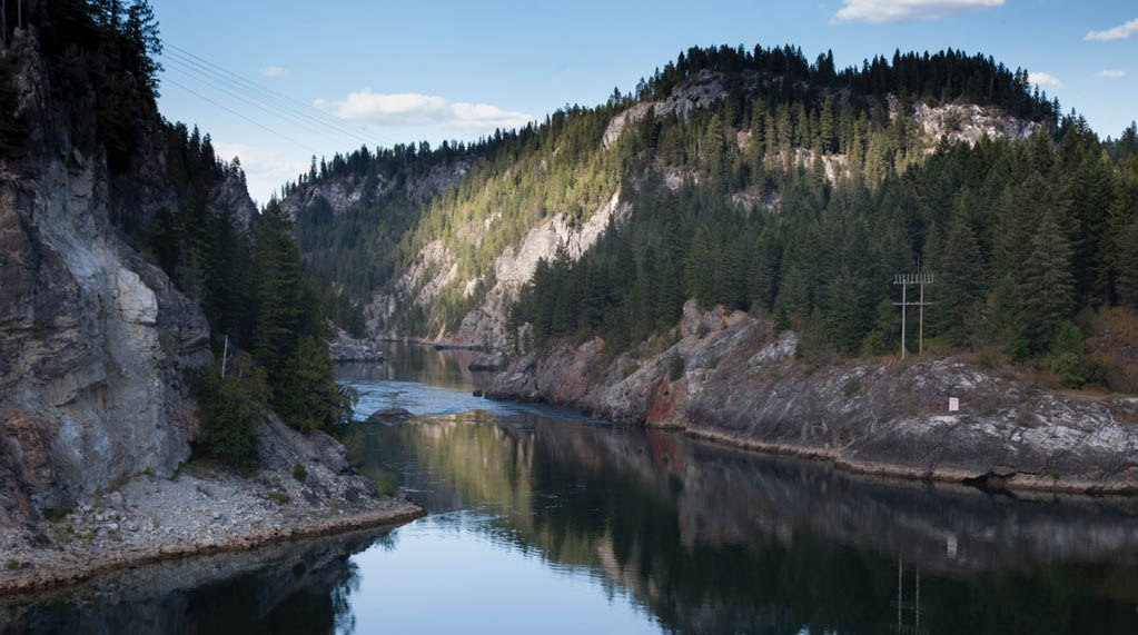
If you go north to the San Juan Islands, you get a lot of glacially scoured bedrock –bedrock that’s geologically a part of the North Cascades!

View across Bellingham Bay to peaks on Cypress Island–one of the San Juan Islands, Washington.
That photo above didn’t make it into the book because it doesn’t really show any geology.
North Cascades (Green colored basement on the cross-section)
One of the great things about the North Cascades is that it exposes basement rock of accreted terranes –fabulously. In the high peaks, the so-called “Crystalline Core” of the North Cascades, you can see the Skagit Gneiss, some of which originated as granitic rock in a magmatic arc much like today’s Cascade Volcanoes, and some of which probably originated as sedimentary rock. All these rocks were metamorphosed at such high temperatures that parts of them actually melted.
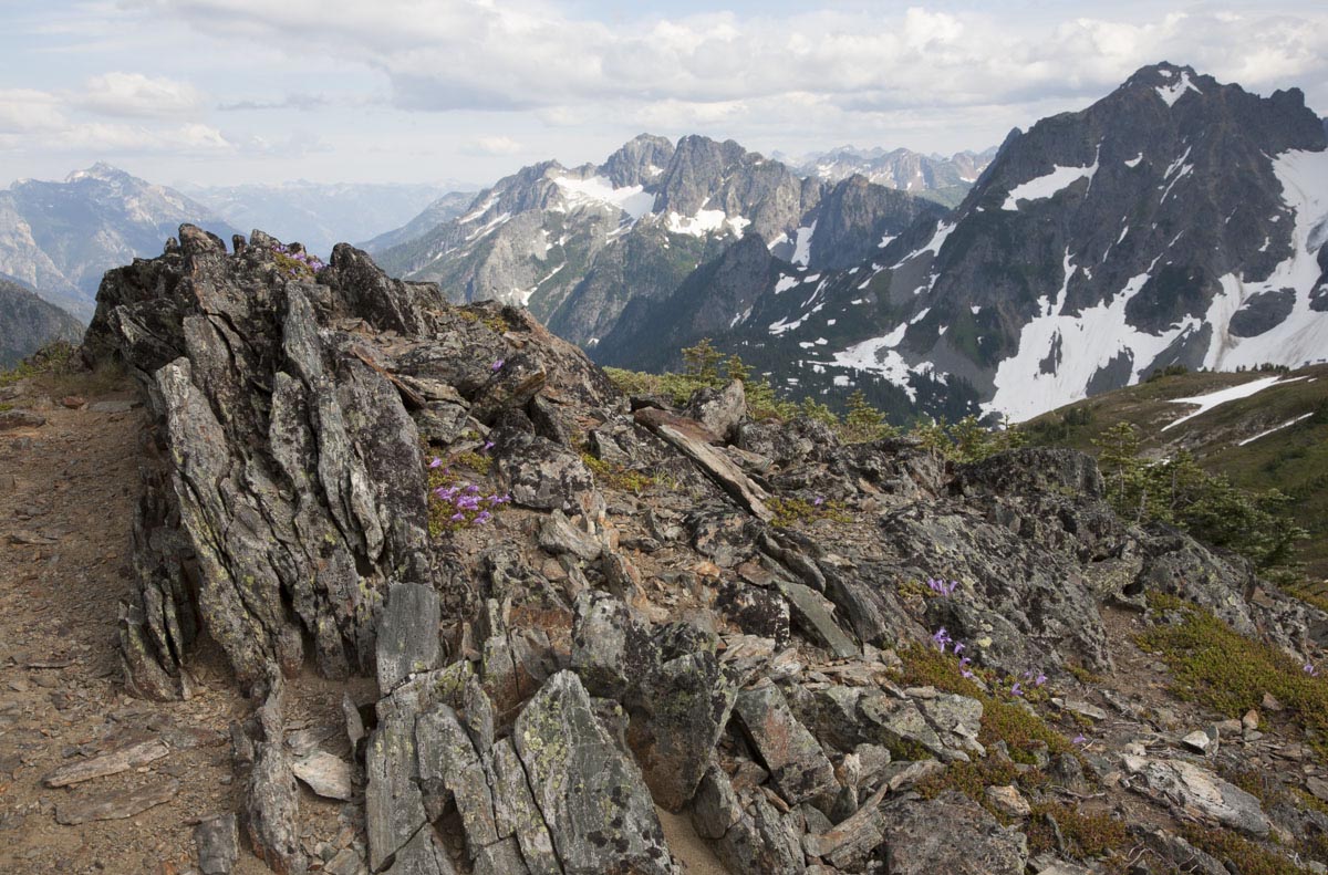
Orthogneiss, metamorphosed igneous rock of Chelan Mountains terrane, North Cascades National Park, Washington.

There’s also metamorphic rock in the western Cascades–including the low-temperature/high pressure type called blueschist –and thrust faulted and folded sedimentary rock in the Methow area, east of the crystalline core.
And poking through the metamorphic rock of the North Cascades are volcanoes, like Mt. Baker! You’ve already seen that out-take, but here it is again.
South Cascades
(pink volcano, pink magma chambers, and light blue layer in the cross-section)
Unlike the North Cascades, which are largely metamorphic and intrusive-igneous, the South Cascades are almost entirely volcanic –and active. Besides ancient volcanoes –and evidence for volcanism dating back 35 million years, the South Cascades host active volcanoes –such as Mt. Rainier (photo below), Mt. Adams, and Mt. St. Helens. If you remember, Mt. St. Helens erupted in 1980 –and has had several steam- and dome-building eruptions since then. A really good source of information on these volcanoes is the US Geological Survey’s Cascade Volcano Observatory.

Nisqually River and Mount Rainier, Washington. River sediment consists of light-colored granitic rocks of the Tatoosh Pluton and dark-colored andesites of Mt. Rainier.
Those big light-colored boulders in the photo above are made of granodiorite of the Tatoosh pluton –which intruded as a series of individual bodies between 26-14 million years ago –and likely fed some eruptions of early Cascade Volcanoes. Erosion has exposed numerous other granitic intrusions in the south Cascades. Wind Mountain in the photo below intruded only 4 million years ago.
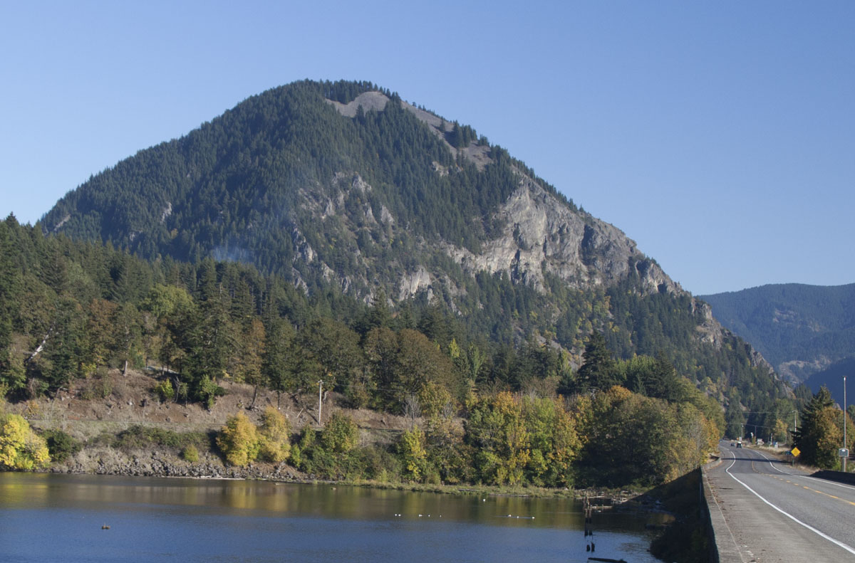
Wind Mountain, a Pliocene intrusion of quartz-diorite along the Columbia River, fed early lavas of the Cascade Volcanoes. The Wind River is in the foreground.
The bright blue layer on the cross-section signifies rocks of the early Cascade volcanoes –such as the Ohanapecosh and Fifes Peak formations. The Ohanapecosh dates back 36 million years. The peaks in the photo below, called the Cowlitz Chimneys, mark a volcanic center for the Ohanapecosh–the white background is the Emmons Glacier on Mount Rainier!

Cowlitz Chimneys, eroded vents for much of the Ohanapecosh Fm. Mt. Rainier National Park.
Okanogan Highlands (yellow accreted terrane labeled “Q” for Quesnellia, dark pink intrusions, blue layer labeled “Pz Sed” for Paleozoic Sedimentary Rock)
Dry and mountainous, the Okanogan Highlands present some of the most complicated geology of the state –including the boundary between Paleozoic North America and the accreted terranes. In the Okanogan Highlands, the terranes all belong to the much larger terrane of Quesnellia.
To represent Quesnellia, the photo below shows the Cave Mountain Formation between the towns of Omak and Tonasket on US 97. This poorly dated limestone is probably Triassic in age and is elsewhere associated with ultramafic bodies typical of deep-level oceanic lithosphere. It’s also highly deformed, something you can’t really see in the photo.

Limestone cliffs of Cave Mountain Formation, part of the Quesnellia Terrane, along US97 in northern Washington.
Intruding Quesnellia are a suite of intrusions, most of which are Cretaceous or Eocene in age (the dark pink intrusions on the cross-section). Those intrusions include the Cretaceous Okanogan Batholith, which occupies a huge area between the Methow and Okanogan rivers (and more), and the Eocene Silver Point Quartz Monzonite, which underlies a large area north of Spokane. Many of the intrusive rocks have been metamorphosed into orthogneiss. In some places, such as along the edges of the Okanogan and Kettle domes, the deformation was so intense that the rock became fine grained and took on a highly foliated nature. We call those rocks, which basically form in high temperature fault zones, “mylonites”. Here’s a photo of some of them below.
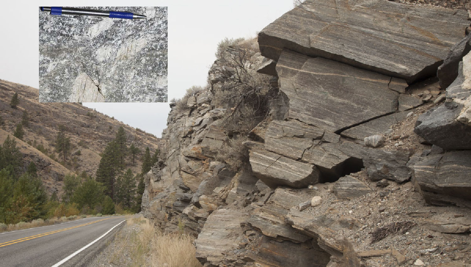
Mylonites along western edge of Okanogan Dome (Metamorphic Core Complex) –on WA 20 near Tonasket. Inset shows close up of foliation surface (xy plane of strain ellipsoid): stretching lineations are parallel to the pen; feldspars are cracked perpendicular to the lineation.
And then there’s Paleozoic North America, lurking in the northeastern corner of the state. You can tell you’re on the ancient continent because of the rock: Cambrian sandstone, overlain by shale, overlain by limestone –the same sequence of rock you see in Montana –or in Death Valley –or near the bottom of the Grand Canyon! The sequence formed when the Cambrian sea moved up and over the continent, depositing its shallow marine sediments. The photo below shows the Metaline limestone near Metaline Falls, Washington. It sits on top metamorphosed shale and sandstone of the Maitlin Phyllite and Addy Quartzite.
Cambrian-Ordovician Metaline Limestone along Pend O’Reille River, at Metaline Falls, Washington.
Columbia Basin –Brown CRBG, green “pC Belt”, and yellowish loess on cross-section
Easily the largest of Washington’s provinces, the Columbia Basin is mostly covered by enormous lava flows of the Columbia River Basalt Group (CRBG). Sitting on top the basalt in many places is windblown dust, called loess. Seems simple, but so much has happened here that it boggles the mind.
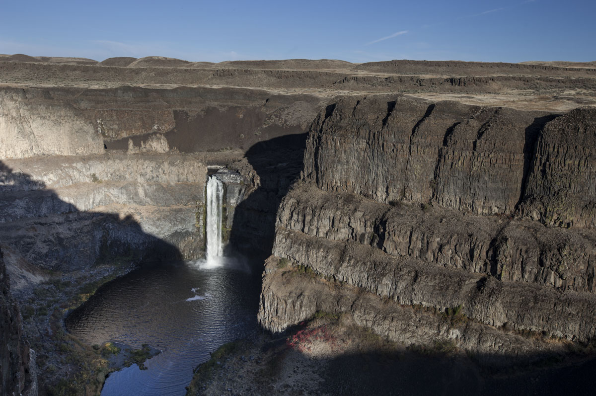
Palouse Falls empties into an over-sized plunge-pool carved into lava flows of the Columbia River Basalt Group by the Ice-Age Floods.
For starters, the Columbia Basin is that part of Washington State most affected by the Ice Age floods –some 40-50 gigantic floods released when impounded river water broke through ice dams at the end of the Pleistocene Epoch, between about 15-18,000 years ago. Several of the floods had discharges of 400x the average flow of the Mississippi River! That’s why Palouse Falls in the photo above seems small relative to the size of its canyon: the canyon was carved during the huge floods–and at even full bore, today’s Palouse River is a tiny trickle in comparison. For a better picture of Palouse Falls –that’s not an out-take, please see my post on Washington waterfalls.
Most floods came from Glacial Lake Missoula in NW Montana, but floods also came from Glacial Lake Columbia in northern Washington and Glacial Lake Kootenay in southern British Columbia. Some of the best sources for information about these floods come from videos made by geologist Bruce Bjornstad and the Ice Age Flood Institute.
And the Columbia River Basalt itself is fascinating. Not only did it cover an area exceeding 70,000 square miles, but some of its flows made it all the way from their sources in eastern Washington and Oregon to the Pacific Ocean. At the Pacific, some of the flows actually intruded the bedrock to form magma chambers! Really! Please see my earlier post on the Columbia River Basalt Group for more details of the flood basalts–as well as some of the wonderful landscapes they created.
There were also volcanically quiet times between eruptions of the flood basalts. During these times, lakes and rivers reestablished themselves and deposited the Ellensburg Formation–which you can see interspersed between many of the lava flows and separating some of the main units like in the photo below.

Ellensburg Formation between flows of the Columbia River Basalt. Note basalt at crest of hill.
To get an idea what’s beneath the CRBG, we can see the older rock poking through the flood basalts in some places. Here’s a photo of Steptoe Butte in eastern Washington, which rises more than 1000′ above the surrounding basalt flows. It’s made of Precambrian quartzite of the Belt Supergroup. On the cross-section, it’s represented by the green layer on the east side.
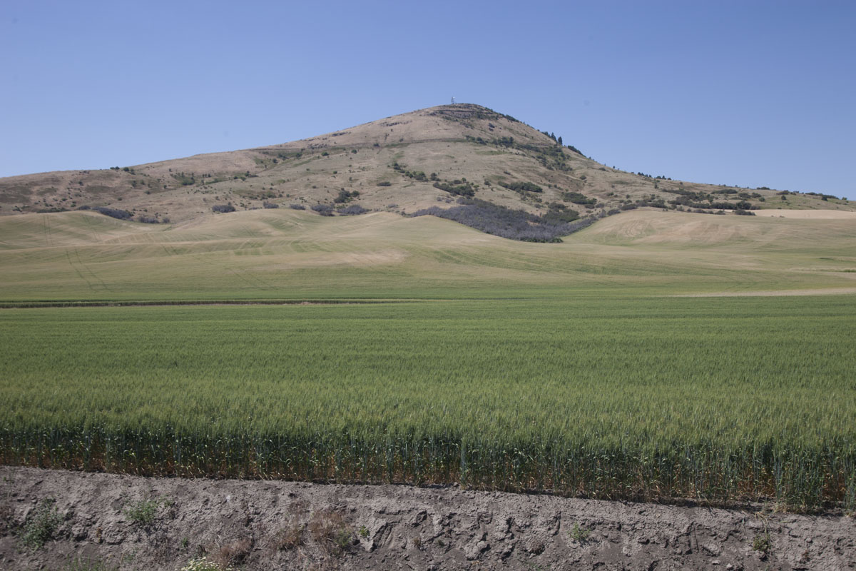
Steptoe Butte, eastern Washington, made of Precambrian Quartzite. It rises more than 1000′ above the surrounding basalt flows of the CRBG.
And all that wheat in the foreground? It’s growing on loess: dust, derived largely from glacial abrasion to the north and deposited by wind on top the basalt flows.
Of course there’s a lot more to Washington’s geology. This post misses some elements of the cross-section, which is itself a huge simplification. But it’s a start –and gives me a chance to plug my book! Here’s what the front and back covers will look like.

Back and front cover for Roadside Geology of Oregon
You can find the book on Amazon, or order it from Mountain Press directly. And I hope you like the book’s photos… none of which are “out-takes” –Enjoy!

Super pumped to see this book! Great photos and that cross section is a winner.
LikeLike
I am very excited to get this! Might you have copies for sale at an upcoming NW Geological Society meeting? http://www.nwgs.org/default.htm.
LikeLike
Great summary! Small correction: pictured is not Lummi Island, rather looking southwest over Clark’s Point, Chuckanut Bay in foreground, to peaks on Cypress Island. Eliza Island to the right-middle forground, and North Samish Island to the left. Bendovi Island center middle.
LikeLike
Thank you! I just now (nearly a month later) saw your correction. I’ll be sure to fix it!
LikeLike
Looking to find links to information regarding potential deadly mudflows from seismic activity on Mt. Rainier. Thank you so much!
LikeLike