Glacier National Park –Proterozoic rock and fossil algae
Glacier National Park’s one of my favorite places. It’s soaring cliffs, waterfalls, and colors are positively amazing –especially the colors. Green green vegetation, and red, white, green, and tan rocks.
To think that these mountains were carved from sedimentary rock that was deposited at sea level and now host glacial cirques and valleys, and even a few remaining glaciers… The rocks are part of the so-called “Belt Supergroup”, which was deposited probably in a large inland sea over what is now much of western Montana, northern Idaho, eastern Washington, and southern BC and Alberta.

Peaks of Glacier National Park and St. Marys River.
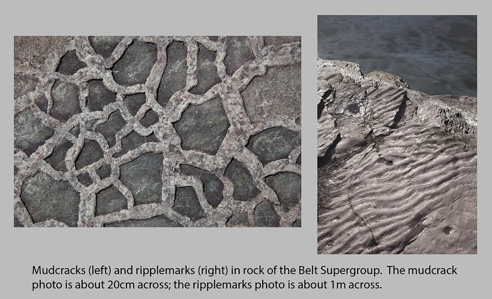
And the rocks are really old–radiometric dating has them as between about 1.4 and 1.5 BILLION years old. Even without that knowledge though, you can guess they’re pretty old because, just about everywhere, they host fabulous sedimentary features like cross-beds, ripple marks, and mudcracks. The sediments were deposited before critters were around to stir up the sediment.
There are some fossils though: stromatalites, which are basically fossilized algae. The algae grew as mats on the ocean floor, and because they were kind of sticky, trapped carbonate sediment. Then they grew over the sediment –and then trapped more. And more –until they created a mound, which in cross section looked like the photo just below –and in plan view, looked like the bottom photo.

cross-sectional view of a stromatalite in the Proterozoic Helena Formation, Glacier NP.
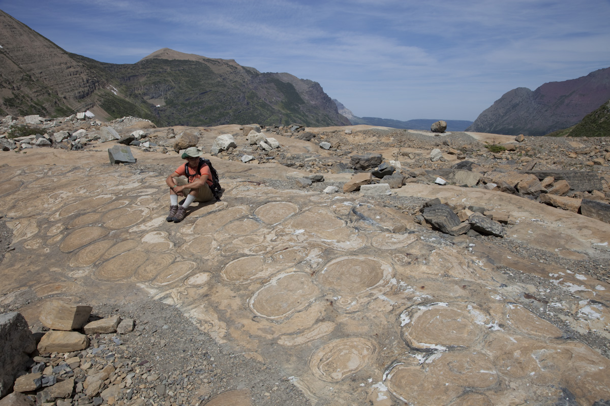
Stromatalites of the Helena Formation as seen in plan view.
for more photos of Glacier National Park, type “Glacier National Park, Montana” into the geology photo search.
Or click here for a freely downloadable geologic map of Glacier National Park.


