geologictimepics

Geology and Geologic Time through Photographs

Archive for the tag “geologic contacts”

Where rocks touch: geologic contacts

Geologic contacts are the surfaces where two different rocks touch each other –where they make contact. And there are only three types: depositional, intrusive, or fault. Contacts are one of the basic concerns in field geology and in creating geologic maps –and geologic maps are critical to comprehending the geology of a given area. For those of you out there who already know this stuff, I’ll do my best to spice it up with some nice photos. For those of you who don’t? This post is for you!

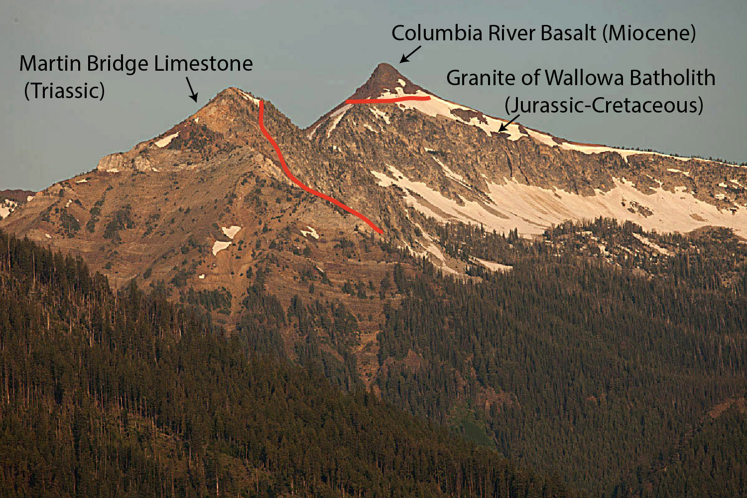
Depositional contacts are those where a sedimentary or volcanic rock was deposited on an older rock (of any type). Intrusive contacts are those where igneous rocks intrude older rock (of any type). Fault contacts are… faults! –surfaces where two rocks of any type have moved into their current positions next to each other along a fault.

In a cross-sectional sketch they may look like this:x-sxnlr

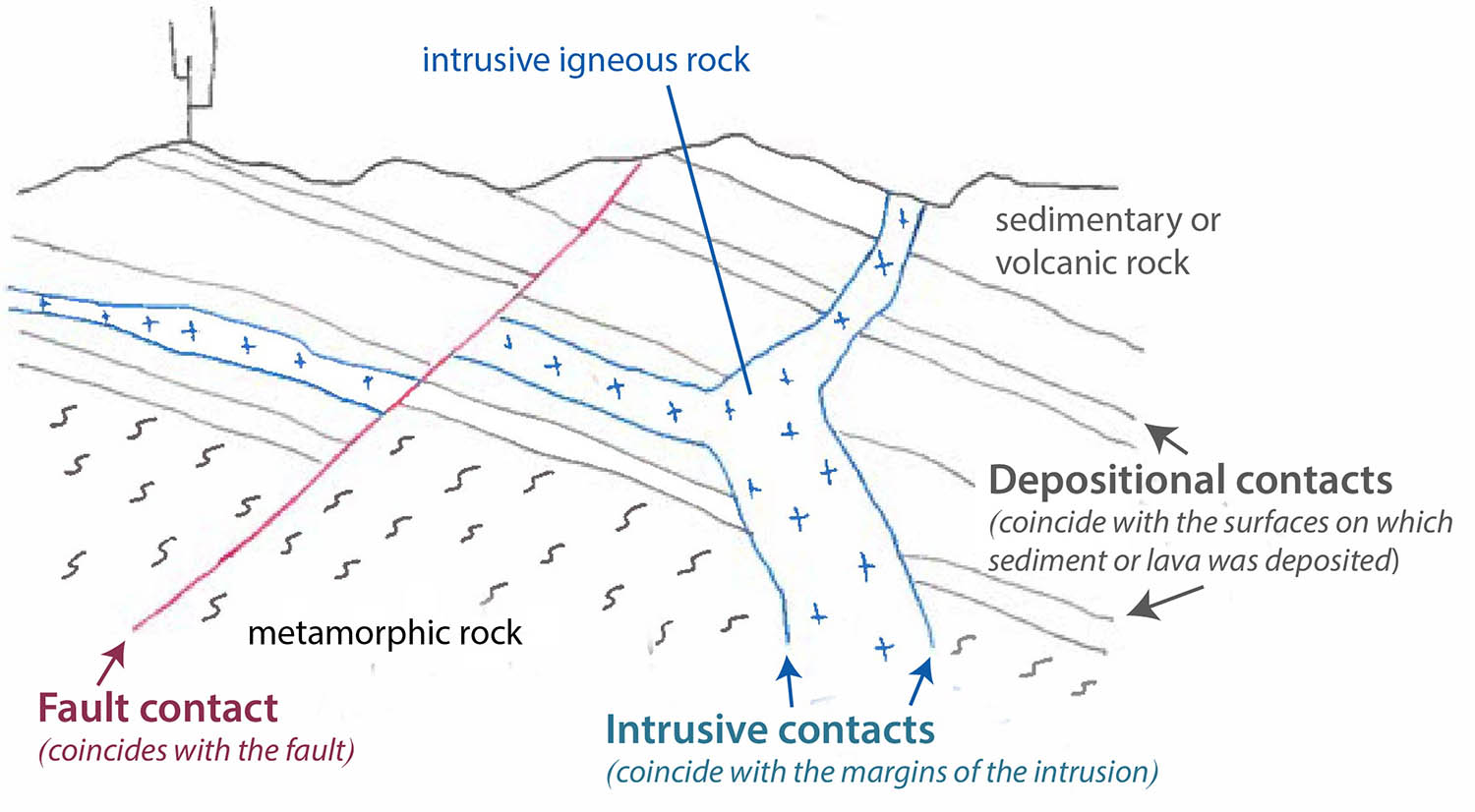
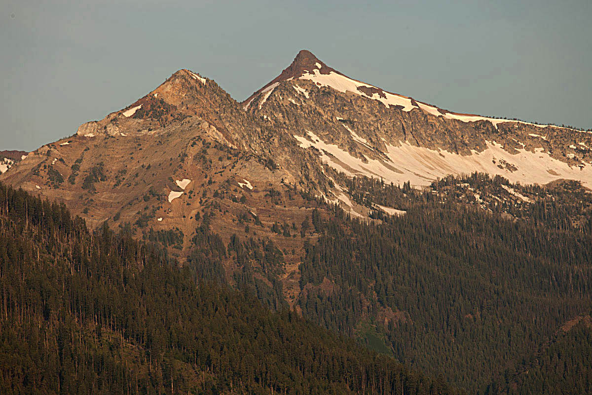
And here are some photos. Click on the image to see it at full size.Depositional contact and windows,  Jurassic Entrada Fm (red) ove

So how do you tell them apart in the field? If the actual contact surface isn’t exposed –which is usually the case– you have to use some indirect observations. Here are some general rules that can help. Of course, each “rule” has exceptions, described later. Read more…

Geologic history of the western United States in a cliff face in Death Valley National Park

Of the many geologic events that shaped the western United States since the beginning of the Paleozoic Era, five really stand out.  In approximate chronological order, these events include the accumulation of tens of thousands of feet of sedimentary rock on a passive margin, periods of compressional mountain building that folded and faulted those rocks during much of the Mesozoic–likely driven by the accretion of terranes, intrusion of subduction-related granitic rock (such as the Sierra Nevada) during the Jurassic and Cretaceous, volcanic activity during the late Cenozoic, and mountain-building by crustal extension during the late Cenozoic and continuing today.  This photo on the western edge of Panamint Valley in Death Valley National Park of California, captures all five.

View of canyon wall on west side of Panamint Valley in SE California --part of Death Valley National Park.  See photo below for interpretation.

View of canyon wall on west side of Panamint Valley in SE California –part of Death Valley National Park. See photo below for interpretation.

The photograph below shows an interpretation.  Paleozoic rock is folded because of the Late Paleozoic-early Mesozoic compressional mountain-building; it’s intruded by Jurassic age granitic rock, an early phase of Sierran magmatism that took place just to the west; the granitic rock is overlain by Late Cenozoic basalt flows, and everything is cut by a normal (extensional) fault.  And there is also a dike that cuts the Paleozoic rock –probably a feeder for the basalt flows.

Interpretation of top photo.

Interpretation of top photo.

So this is all nerdy geology cross-cutting relations talk –but here’s the point: in this one place, you can see evidence for 100s of millions of years of Earth History.  Earth is old old old!  THAT’S why I love geology!

And for those of you who crave geologic contacts?  This photo has all three: depositional, between the basalt and underlying rock; intrusive, between the Mesozoic granite and the folded Paleozoic rock; fault, the steeply dipping black line between the basalt and the Paleozoic rock.  Another reason why I love geology!


click here to see photos and explanations of geologic contacts.
or click here for a slideshow of Death Valley geology.

Geologic Time in a mountainside –the Wallowa Mountains from Joseph, Oregon

Joseph, Oregon is a wonderful place for geology.  The town sits right at the foot of the Wallowa Mountains in the northeastern corner of Oregon.  The mountains rise some 4-5000′ abruptly from the valley floor along a recently active normal fault.

The Wallowa Mountains rise along a fault zone just south of the town of Joseph.

The Wallowa Mountains rise along a fault zone just south of the town of Joseph.

In the mountains, you can see some bedrock relations that speak to great lengths of geologic time.  An erosional remnant of the Columbia River Basalt Group caps Sawtooth Peak in the photos below; it sits directly on granite of the Wallowa Batholith –and just a little bit south, on the next peak, the granite intrudes Martin Bridge Limestone!  So, from oldest to youngest, the rock units are the Martin Bridge Limestone, the Wallowa granite, the Columbia River Basalt.

Sawtooth Peak (right) capped by Columbia River Basalt.  Beneath it is granite of the Wallow Batholith --and off to the left, are the bedded rocks of the Martin Bridge Limestone.

Sawtooth Peak (right) capped by Columbia River Basalt. Beneath it is granite of the Wallowa Batholith –and off to the left, are the bedded rocks of the Martin Bridge Limestone.  See below for labels.

Rock units and contacts described in the text

Rock units and contacts described in the text

Never mind that we know the Martin Bridge Limestone is Triassic –so more than 200 million years old –and that the Wallowa Batholith formed at different times between 140 to about 120 million years ago –and that the basalt is about 16 million years old.  You can throw out radiometric dating, but even so, you’re looking at a great span of geologic time.  The limestone first had to be deposited, layer after layer –and then buried –and then intruded at a depth of 5-8 km by the granite –which THEN had to get uplifted to Earth’s surface so the basalt could flow over it.  After THAT, it all had to get uplifted to its present elevation along the normal fault just south of town and much of the basalt had to erode away.

Honestly, we have influential people in this country who spout off things like the Earth is only 6000 years old.  They also deny the overwhelming evidence for climate change.  I guess I should stop writing now before I get too worked up!


More photos of the Wallowas at Geologic Photography.

Post Navigation